The Comparison at a Glance
Factor | DJI FlightHub 2 | DJI Terra |
|---|---|---|
Price | £170.00 (Business, 1 Month) to £1,019.00 (Business, 1 Year) | £1,600.00 (Standard, 1 Year) to £11,150.00 (Flagship + Modify, Permanent) |
What it is | Cloud-based fleet operations platform | Desktop data processing software |
Runs | During and around the flight | After the flight, on already-captured data |
Live fleet control | Yes, multi-drone Virtual Cockpit, real-time dashboard, livestream sharing | No |
Flight planning | Yes, 3D route editing for patrol, inspection, mapping and corridor missions | No, missions are flown in DJI Pilot 2 or via FlightHub 2 itself |
2D/3D data processing | Yes, cloud-based, built to a stated 1:500 scale mapping accuracy | Yes, desktop-based, photogrammetry, LiDAR processing and Gaussian Splatting |
Native Zenmuse LiDAR processing | Not stated on DJI's own FlightHub 2 feature page | Yes, Zenmuse L1/L2/L3 point clouds natively |
AI analytics | Yes, object detection and counting, automated alerts, multimodal search | No |
Offline / on-premises use | On-premises deployment available as a separate option | Yes, offline activation on Standard and Permanent tiers |
FlightHub 2 Runs the Fleet, Terra Processes What It Captures
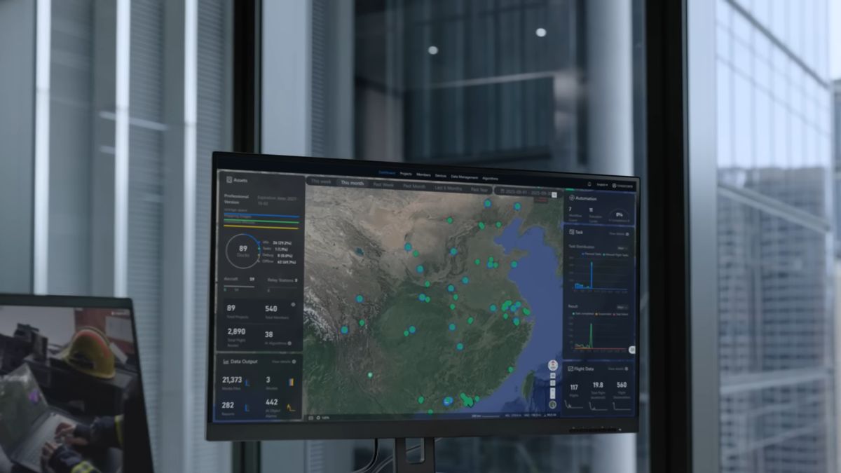
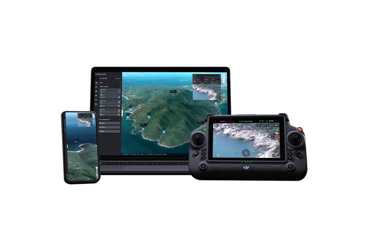
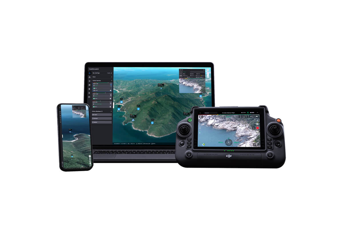
FlightHub 2's core job is managing aircraft while they're flying: a Virtual Cockpit for controlling multiple drones from one dashboard, real-time device status, and livestream sharing with simultaneous multi-drone monitoring. Its flight planning covers 3D route editing for patrol, inspection, mapping and corridor missions, with automated route planning for emergency response tasks built in.
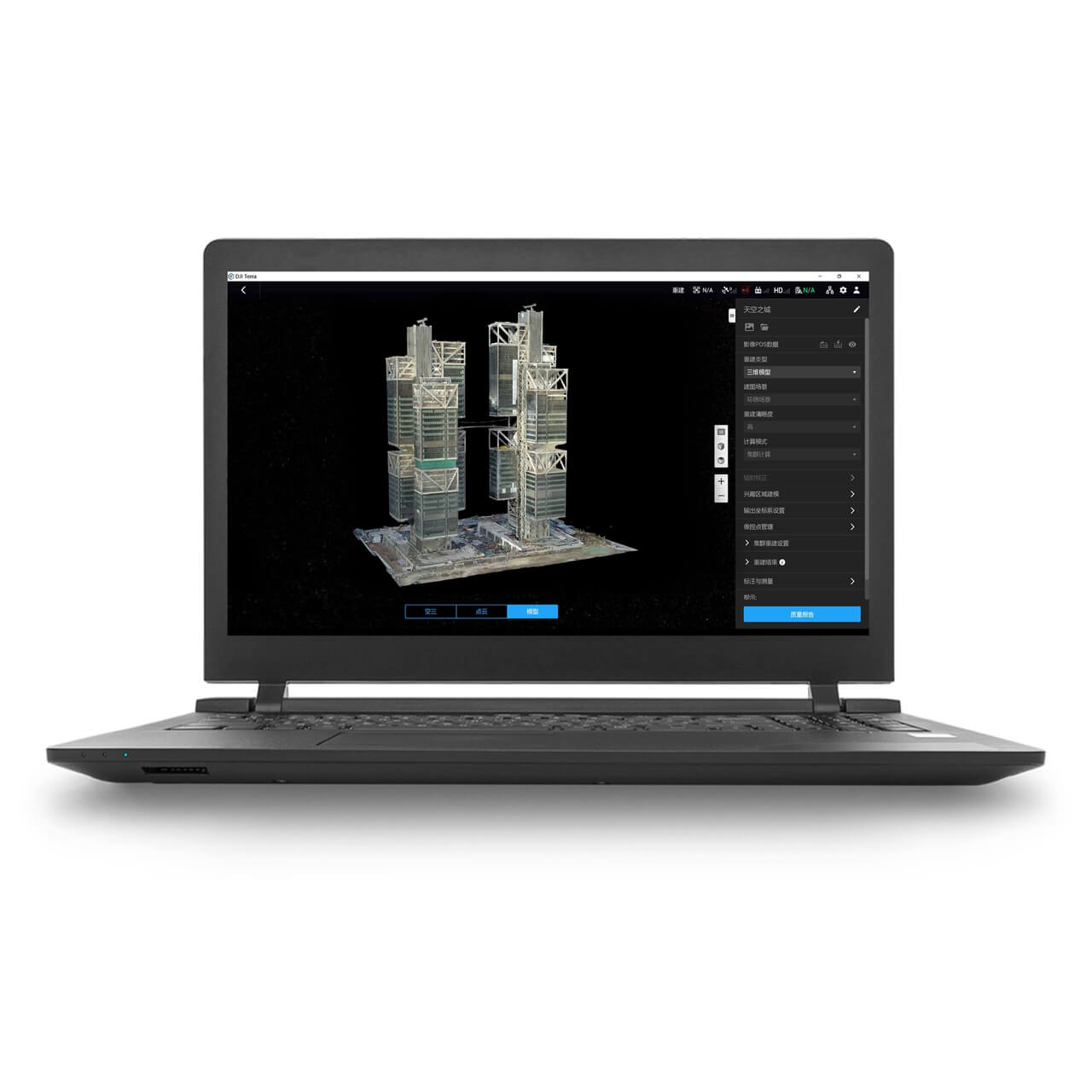
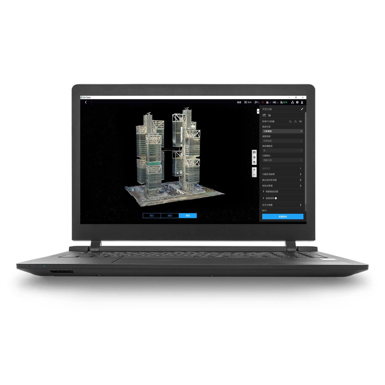
DJI Terra doesn't touch any of that. It takes the imagery and LiDAR data a flight has already captured, whether flown manually, through DJI Pilot 2, or through FlightHub 2 itself, and reconstructs it into an orthomosaic, a 3D mesh or a LiDAR point cloud. One tool manages the flight, the other turns what the flight captured into a usable deliverable.

Both Now Do Some Level of Mapping, Just Not the Same Job
FlightHub 2 includes its own cloud-based 2D/3D modelling and point cloud generation, built to a stated 1:500 scale mapping accuracy according to DJI's own FlightHub 2 documentation, generated straight from a completed flight without leaving the platform. That's built for a fast operational turnaround, a usable overview shortly after the aircraft lands, not a survey-grade deliverable.
DJI Terra's processing sits at the other end of that scale: native Zenmuse L1/L2/L3 LiDAR point cloud processing, 3D Gaussian Splatting, and multispectral crop analysis on the Flagship tier, none of which appear on FlightHub 2's own feature list. A quick situational map generated during or right after a flight suits FlightHub 2's built-in processing; a detailed, LiDAR-accurate model for a client, a survey deliverable or a regulator suits DJI Terra instead.
Live Fleet Control Is FlightHub 2's Alone
Multi-drone Virtual Cockpit control, real-time dashboards, livestream sharing, AI-driven object detection and counting, automatic alerts, and a multimodal search that can find objects across live feeds by text or image, none of this exists in DJI Terra at all. Terra isn't built to run live operations, it's built to process data that's already been captured.
A public safety team coordinating several aircraft at once, or an inspection team that needs eyes on a live feed with automated alerts, needs FlightHub 2 for that regardless of which software processes the resulting data afterward. DJI Terra has no answer to any of this, because it isn't trying to.
Choosing Between FlightHub 2 and Terra, or Running Both
An operation that only needs to turn already-captured imagery or LiDAR into a finished model, with no need for live fleet control, dashboards or AI monitoring, only needs DJI Terra. An operation managing multiple aircraft in real time, running automated missions or needing a live operational dashboard, needs FlightHub 2 regardless of which software eventually processes the data it captures.
Most DJI Enterprise operations running both mapping payloads and multi-aircraft fleets, particularly in public safety and infrastructure inspection, end up running both together: FlightHub 2 for the live side of the operation, DJI Terra for the finished deliverable. Drone Safe Store carries both directly as an official DJI Enterprise partner, with genuine UK stock, fast-tracked shipping and iwocaPay financing available across both licences.
Common Questions
No, FlightHub 2 runs independently as a fleet operations platform. Its own cloud-based 2D/3D modelling covers a basic mapping need without Terra, though Terra's LiDAR processing and higher-precision output aren't part of FlightHub 2 at all.
For a fast, operational-accuracy overview, yes. For LiDAR point cloud processing, 3D Gaussian Splatting or multispectral crop analysis, no, none of these appear on FlightHub 2's own feature list, that's Terra's job.
Yes, Terra processes any captured DJI flight data regardless of whether the mission was flown through FlightHub 2, DJI Pilot 2, or another compatible method.
Often both: FlightHub 2 for live multi-aircraft control, dashboards and AI-driven monitoring, DJI Terra for turning the captured imagery or LiDAR into a finished model afterward.