
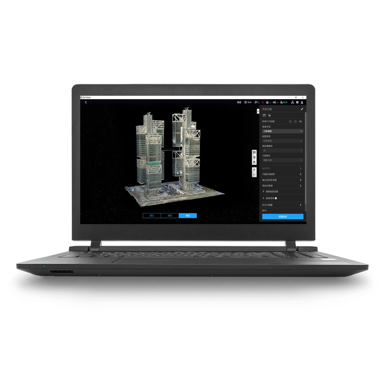
DJI Terra - Standard 1 Year
SKU: CP.RJ.00000234.01 Material Code: DJIETERSTD1YR Brand: DJI
Includes VAT · pay in 3 from £533.33 with Klarna
- High Accuracy 3D Mapping
- LiDAR Point Cloud Processing
- Multispectral Vegetation Index Analysis
Order within 17 hrs 34 mins for delivery by Friday, 23rd October (UK Mainland)
Free collection from our Chichester Experience Centre

Pay Safely & Securely With


VIP Membership
Join the club & save £££ - Thousands saved over the years!
DJI Terra Standard, 1 Year Licence
Compatible with DJI Matrice, Mavic 3 Enterprise, and Dock deployments.
The annual Standard licence covers the full DJI Terra workflow: 2D orthomosaics, 3D reconstruction, LiDAR point cloud processing, and multispectral analysis, on a twelve month term. Best suited to operators testing the workflow, or running project-driven mapping where a perpetual commitment isn't yet justified.
Which Terra Licence Do You Need
Four licences are available. They produce the same core outputs, so the decision is dataset size and how long you'll use it:
| Licence | Term | Best for | Price |
|---|---|---|---|
| Standard, 1 Year (this listing) | 12 months | Testing the workflow, project-driven mapping | £1,600 |
| Standard, Permanent | Perpetual | Regular mapping as a core service | £4,550 |
| Flagship, 1 Year | 12 months | Large datasets and advanced processing, annually | £3,260 |
| Flagship, Permanent | Perpetual | High-volume survey businesses | £9,310 |
Annual or permanent? A permanent Standard licence costs roughly three annual licences, so break-even sits around the three year mark. If mapping is a core ongoing service, permanent is better value. If you're trialling Terra, or your work is seasonal or project-driven, annual keeps the commitment lower.
Standard or Flagship? Standard covers most construction, inspection, and land survey requirements, including LiDAR point cloud processing. Flagship adds capability for larger datasets and more advanced processing, aimed at high-volume or corridor-scale work. Call us with your typical project size and we'll tell you honestly which one you need, including when Standard is the right answer.
End-to-End Drone Mapping Workflow
Plan flight routes, capture data efficiently, and process outputs in one seamless software platform.
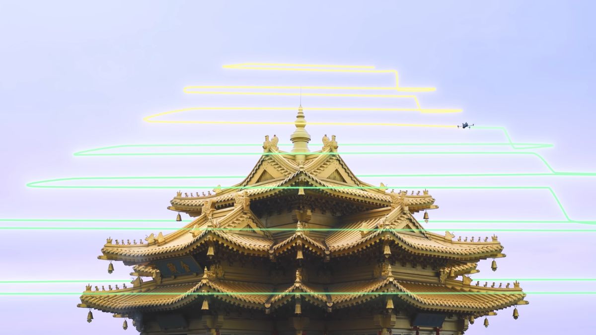
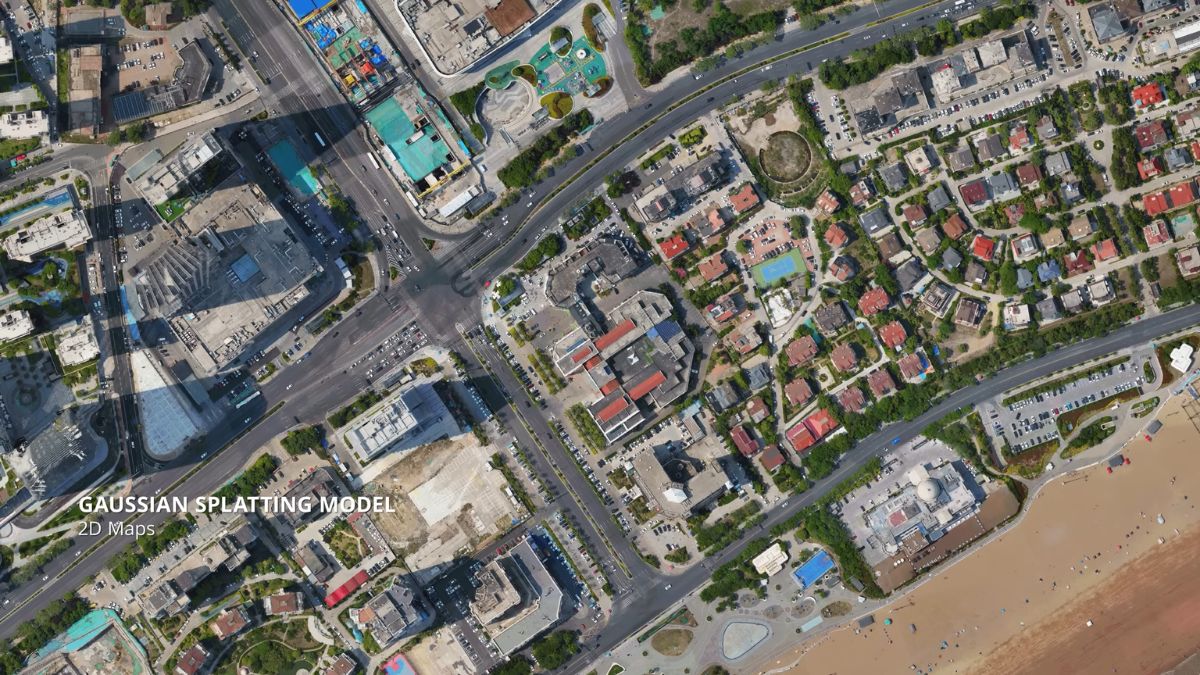
High-Accuracy 2D & 3D Reconstruction
Generate centimetre-accurate orthomosaics, dense point clouds, and realistic 3D meshes from DJI mapping drones.
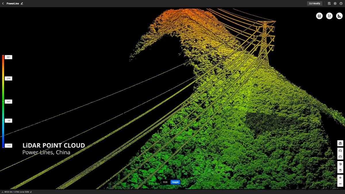
LiDAR Point Cloud Processing
Fully compatible with Zenmuse L1, L2, and L3 payloads, supporting RTK/PPK workflows and advanced classification for terrain modelling.
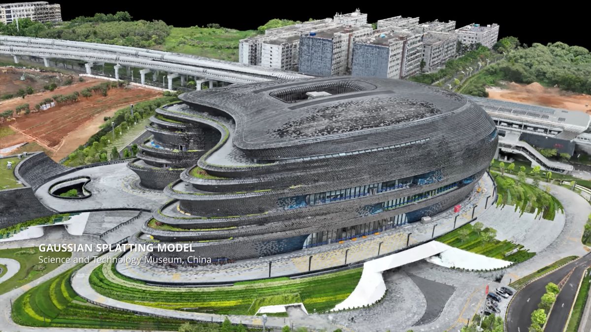
Gaussian Splatting for Photorealistic Models
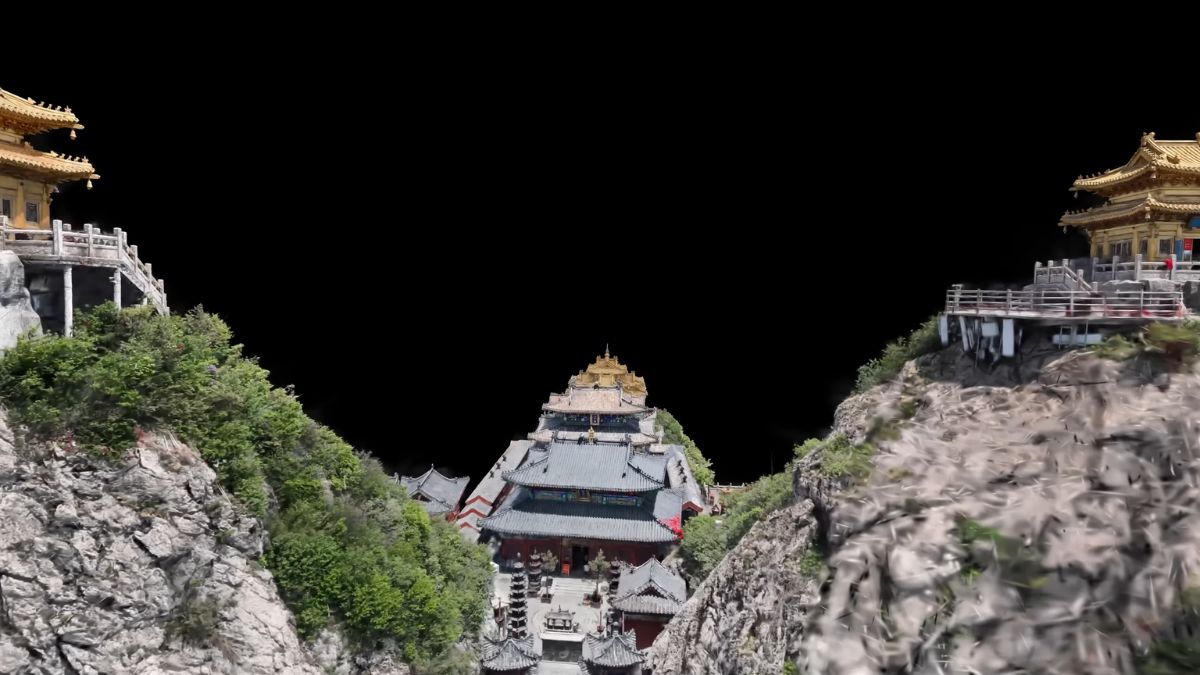
Create true-to-life 3D models with real-time rendering, ideal for heritage, tourism, construction visualisation, and digital twin applications.
Multispectral Crop & Vegetation Analysis
Produce NDVI and NDRE vegetation index maps using platforms such as Mavic 3 Multispectral for precision agriculture and environmental monitoring.
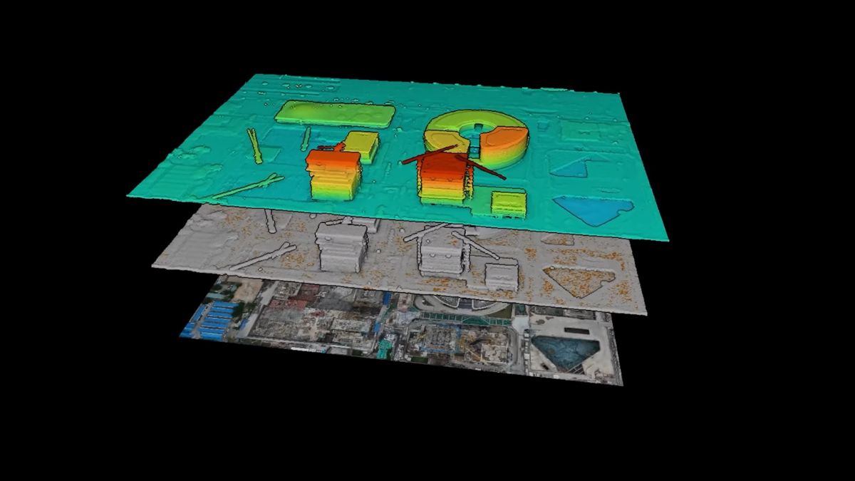
Massive Scale Capability
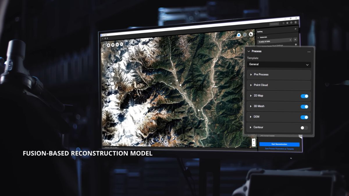
Terra supports large-area processing with cluster reconstruction technology, enabling city-scale modelling and high-volume dataset handling.
Flexible Export & Compatibility
Output common formats including TIFF, LAS, OBJ, DXF, SHP, and 3D Tiles for easy integration into GIS, CAD, BIM, and third-party software.
Ideal For
- Surveying and mapping professionals
- Construction progress and volumetrics
- Utilities and infrastructure inspection
- Public safety and incident response
- Agriculture and crop health monitoring
- Cultural heritage preservation
- Drone-in-a-box and remote operations (DJI Dock 3 and Dock 2 compatible)
Which Aircraft Feed Into Terra
- DJI Matrice 400 with the Zenmuse L3 or Zenmuse P1
- DJI Matrice 350 RTK and Matrice 300 RTK with the Zenmuse L1, Zenmuse L2, or Zenmuse P1
- DJI Matrice 4 Series, particularly the Matrice 4E with 5-directional oblique capture
- DJI Mavic 3 Multispectral for reflectance and vegetation index mapping
- DJI Dock 3 deployments, where automated missions feed directly into a Terra workflow
Frequently Asked Questions
How is the licence delivered?
As a digital licence code sent by email after purchase, not a physical product. Our team will confirm activation details and can walk you through setup.
What happens when the twelve months expire?
The licence stops working and needs renewing to continue processing. Projects already exported remain yours. If you expect to still be using Terra in three years, the permanent licence works out cheaper overall.
Does Terra run on Mac?
No. Terra is a Windows application. Processing demands scale with dataset size, particularly for LiDAR and large-area reconstruction, so check DJI's current published system requirements against your machine before buying. Call us with your specifications and typical dataset sizes and we'll tell you whether it will cope.
Do I need DJI Modify as well?
Not necessarily. Modify handles model cleanup, repairing mesh errors and filling holes before client delivery. Worth adding if you deliver 3D models commercially and currently export them into third-party software for tidying. If your deliverables are mainly 2D orthomosaics or point clouds, Terra alone is usually enough.
What's the difference between Terra and FlightHub 2?
Terra is desktop software that processes captured data after a flight. FlightHub 2 is a cloud platform managing the flight itself: mission planning, live streaming, telemetry, and fleet coordination. Many operations run both, and FlightHub 2 is required for Dock 3 deployments.
Can I try Terra before buying?
DJI offers a trial version with limited functionality. For a proper assessment against your own data, speak to our team first.
Is a licence tied to one machine?
Licensing is per device. If you need Terra across multiple workstations, call us before ordering so we can quote correctly rather than you buying the wrong configuration.
Can I get this on finance?
Ltd companies can spread the cost with iwocaPay, and individual buyers can use Klarna or Clearpay at checkout.
Why Buy DJI Software From Drone Safe Store
We supply genuine DJI licences with full DJI support, not resold or grey market keys. The gap between Standard annual and Flagship permanent is over £7,700, so our team will talk through your actual project volume before you commit, including when the cheaper licence is the right answer. As a DJI Enterprise A-Rank retailer we can also supply the aircraft, payload, ground control, and software together, configured to work as one workflow.
Where to Find Us
Drone Safe Store Showroom
Unit 1K, St James' Industrial Estate, Westhampnett Rd, Chichester PO19 7JU
Opening Hours: Monday to Saturday, 9:00am to 5:30pm
Get In Touch
Not sure whether Standard covers your work, or whether annual beats permanent? Call us.
What our customers say - 1,778+ Google reviews
"The team are super helpful, knowledgeable and nothing seems too much trouble. Fast reliable delivery. I will definitely order with them again."
"Informative and helpful."
"Fabulous , friendly family business. Honest opinions given and no pressure sales"
Accreditation
 Armed Forces Covenant
Proudly supporting the Armed Forces community and veterans.
Armed Forces Covenant
Proudly supporting the Armed Forces community and veterans.
 ISO 9001 Certified
Certified quality management systems for consistent service and customer satisfaction.
ISO 9001 Certified
Certified quality management systems for consistent service and customer satisfaction.
 DJI Enterprise A Rank Retailer
DJI's highest level of authorised retail and technical expertise.
DJI Enterprise A Rank Retailer
DJI's highest level of authorised retail and technical expertise.
 D-U-N-S® Registered
Globally recognised business identity, verified for international trade. Number: 221162020
D-U-N-S® Registered
Globally recognised business identity, verified for international trade. Number: 221162020
 Financial Conduct Authority
Authorised and regulated by the FCA for consumer finance activities.
Financial Conduct Authority
Authorised and regulated by the FCA for consumer finance activities.
 YPO Approved Supplier
Approved on the YPO framework as a supplier for Drones & Associated Services to help the Public Sector
YPO Approved Supplier
Approved on the YPO framework as a supplier for Drones & Associated Services to help the Public Sector