


DJI Mavic 3 Multispectral
- Realtime NDVI
- 4x 5MP spectral bands
- 20MP RGB camera
- Realtime terrain-follow
- RTK with centimetre-level accuracy
- DJI SmartFarms software
SKU: CP.EN.00000445.01
Material Code: 298630
Brand: DJI
Included with the DJI Mavic 3 Multispectral
Over £510.00 worth of extras included with the DJI Mavic 3 Multispectral!
-
 Drone Safe Register Professional - 1 Year RRP: £238.79
 -
 RTK Network Subscription Unlimited 30 Days RRP: £180.00
 -
 A2CofC Online Training Course RRP: £100.00
Next Day Delivery
In Stock : Order within 03 hrs 14 mins for delivery by Friday, 17th July (UK Mainland)

Safe & Secure Checkout
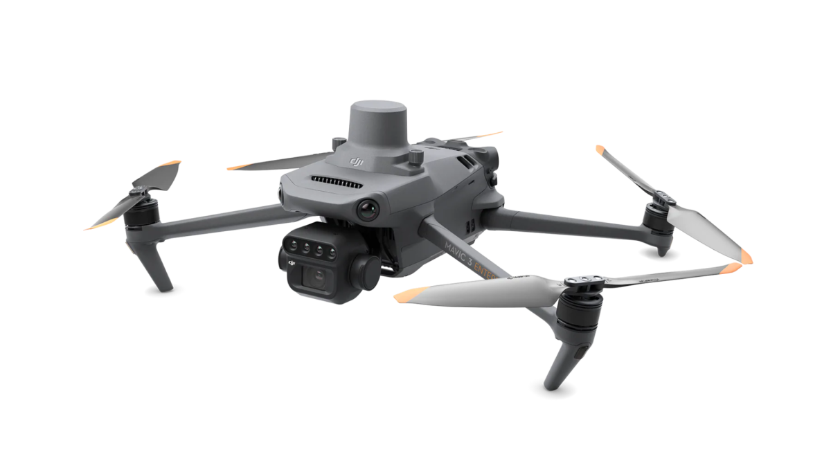
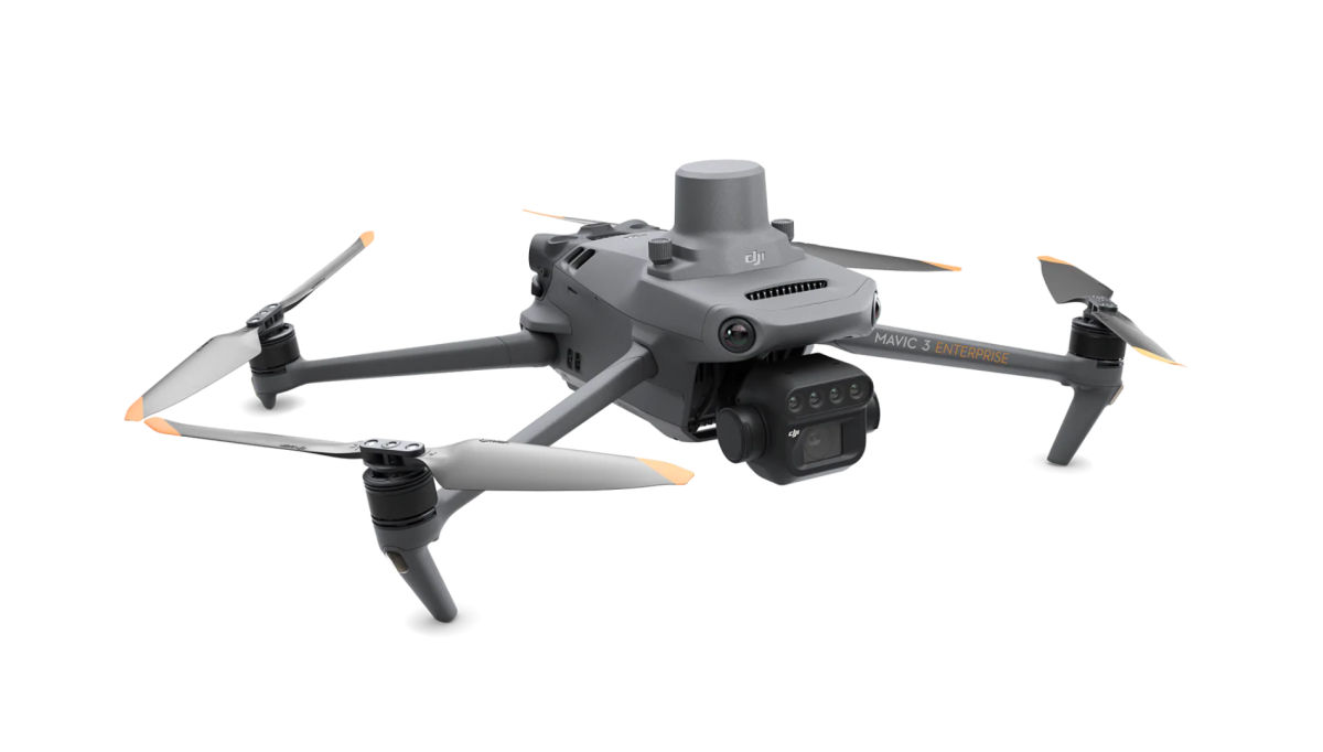
DJI Mavic 3 Multispectral
Effective aerial surveying needs to see the invisible. That's why Mavic 3 Multispectral has two forms of sight. It combines an RGB camera with a multispectral camera to scan and analyze crop growth with total clarity. Agricultural production management requires precision and data, and Mavic 3M delivers both.
1 x DJI Mavic 3 Multispectral Drone
1 x DJI Mavic 3 Intelligent Flight Battery
1x DJI Mavic 3 RTK Module
1 x MicroSD Card
1 x DJI RC Pro Enterprise
1 x Power Cable
1 x USB-C Cable
3 x Propeller (pair)
1 x Charger
1 x USB-C to USB-C Cable
1 x Carrying case
1 x Screwdriver
- Realtime NDVI
- 4x 5MP spectral bands
- 4x 5MP spectral bands
- Realtime terrain-follow
- RTK with centimetre-level accuracy
- DJI SmartFarms software
Multispectral Camera
4 × 5MP
G/R/RE/NIR
RGB camera
20 MP
4/3 CMOS, mechanical shutter
Safe and stable
Omnidirectional Obstacle Avoidance
15km Transmission Distance
Precise positioning
Centimeter-level RTK positioning
Microsecond-level time synchronization
Efficient aerial surveying
Up to 200 hectares per flight
Multispectral + RGB imaging system
Newly upgraded imaging system with one 20MP RGB camera and four 5MP multispectral cameras (green, red, red edge, and near-infrared). Enables applications such as high-precision aerial surveying, crop growth monitoring, and natural resource surveys.
Sunlight Sensor
The built-in sunlight sensor captures solar irradiance and records it in an image file, allowing for light compensation of image data during 2D reconstruction. This results in more accurate NDVI results, as well as improved accuracy and consistency of data acquired over time.
RTK module
Accurate images that capture every pixel
Mavic 3M with RTK module for centimeter-level positioning. Flight control, the camera, and the RTK module sync in microseconds to accurately capture the location of each camera's imaging center. This enables Mavic 3M to do high-precision aerial surveying without using ground control points.
Efficient and reliable battery life
43 minutes Cruise time
200 hectare
A single flight can complete mapping operations over an area of 200 hectares.
Fast charging
100W Battery Charging Hub - High-efficiency fast charging
Submit Your Review
Your email address will not be published. Required fields are marked *
Great customer service - super friendly and shows an interest. Highly recommended. Second time using them now for my drone equipment

Great no nonsense ordering process. Also got not only a cheaper deal than John Lewis but a free micro sd card 128gb ....For my order of Osmo Pocket 4

Excellent service item as described and super fast hassle free delivery couldn’t believe how quick it arrived. Would strongly recommend the Drone Safe Store

The guys at the store were really helpful, great knowledge of products and what was best me. Thank to Dan who had great customer service and Harrison for technical assist...

Great service from Drone Safe! Everything went smoothly, the drone arrived quickly and in perfect condition. I'm very happy with my purchase and would definitely recommen...

Excellent service, this was the second Dji drone I've purchased from Drone Safe Store and I cant fault them whatsoever. I used Clearpay to spread the cost over 6 weeks wh...

Super fast dispatch and when there was a slight issue with delivery Drone Safe Store were really quick to respond and resolve the issue

Fair price, excellent communication and fast delivery
