What Drone Do I Need For Mapping?
You might be asking yourself… what drone do I need for surveying? What camera is best suited for 3D mapping? What are the best drones for mapping? Well, look no further as in this blog we are going to be going into detail about mapping drones and cameras.
Surveying & Mapping

What is Drone Surveying?
A drone survey is used to collect data using sensors such as RGB or multispectral cameras, as well as LIDAR payloads. During a drone survey, the terrain is photographed numerous times from various perspectives, and each image is labelled with coordinates.
After the drone survey, you'll require photogrammetry software to create 3D models of the project area in post-production. Drone mapping is a low-cost, high-quality option that is faster and less expensive than manned aircraft.
What is Drone Mapping?
Drone mapping involves getting hundreds of aerial images together and then putting them together digitally with specialised mapping software to make a bigger and more accurate image.
What is a LIDAR Camera?
A LIDAR Camera has a pulsed laser which records how long it takes at impressive nano-second speeds. This allows it to generate a 3D model with better accuracy than a normal camera ever could.
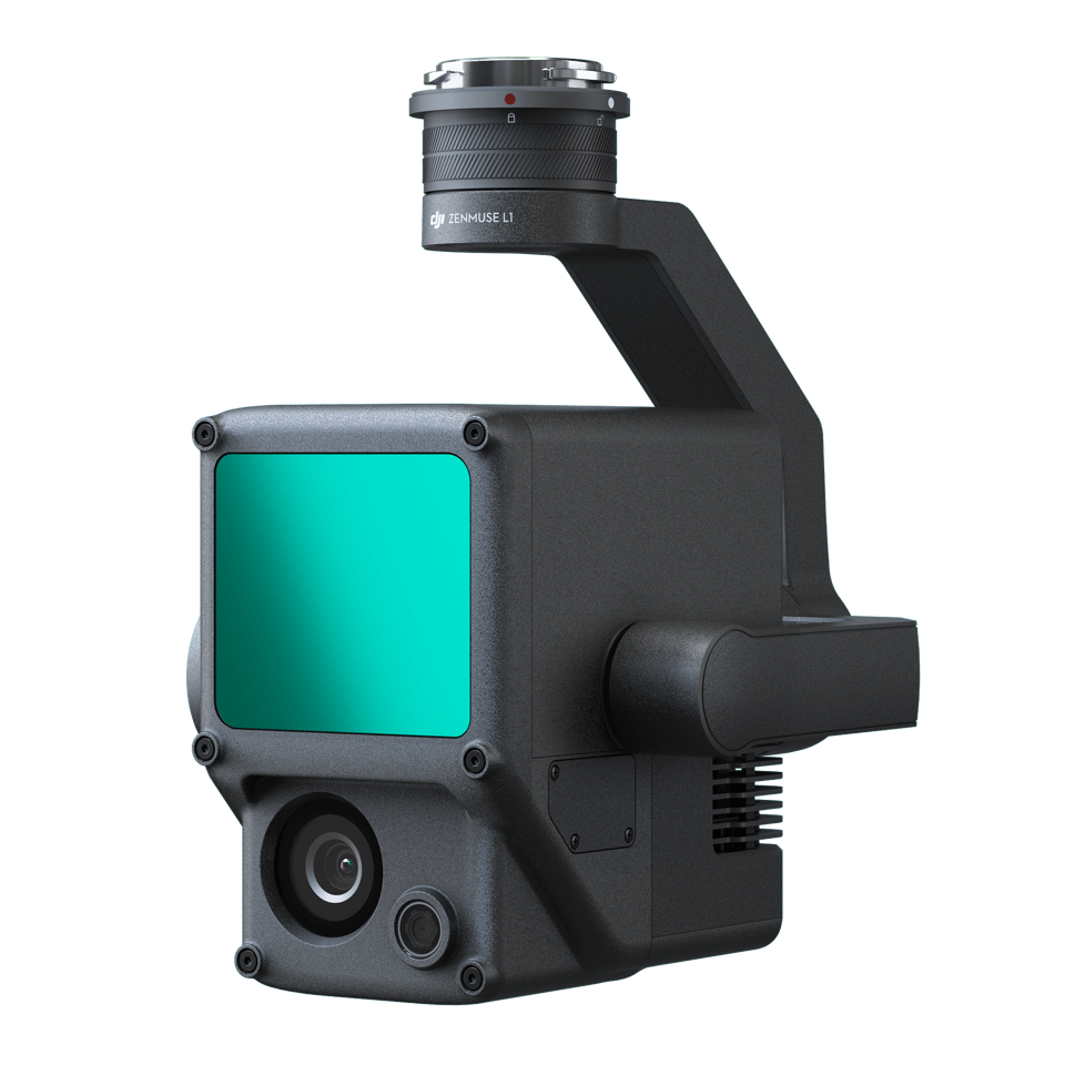
The DJI Zenmuse L1
A Lidar + RGB Solution for Aerial Surveying
The Zenmuse L1 integrates a Livox Lidar module, a high-accuracy IMU, and a camera with a 1-inch CMOS on a 3-axis stabilised gimbal. When used with Matrice 300 RTK and DJI Terra, the L1 forms a complete solution that gives you real-time 3D data throughout the day,
Features
Point Rate: 240,000 pts/s
Point Cloud LiveView
IP54 Ingress Protection Level
High Accuracy
20MP
1-Inch CMOS
Mechanical Shutter
The DJI Phantom 4 RTK
The P4 RTK is a mapping drone that can collect data with extreme precision. DJI Terra, the company's latest 3D mapping program, is compatible with it. The RTK is so precise that it will blow your mind.
DJI Phantom 4 RTK

The Mapping Solution For Enterprise
The Phantom 4 RTK is a mapping drone that can collect data with extreme precision. DJI Terra, the company's latest 3D mapping program, is compatible with it. The RTK is so precise that it will blow your mind.
Features
30 Mins Flight Time
20MP 1-Inch Sensor
Built-in RTK
It can generate incredibly precise data. The major goal of this drone was to achieve accuracy. This Phantom 4 is on par with some of the most advanced equipment on the market but in a lot more user-friendly, lower-cost, and compact, reliable packaging.
The new Phantom 4 RTK technology means that fewer ground points are needed to get the same level of high level of accuracy.
Phantom 4 RTK Questions
How does the Phantom 4 use RTK?
The RTK module sits on top of the P4 body and continuously captures centimetre-level location data. The image information is then updated with this incredibly precise data. These modules work together to provide reliable data collection for a variety of mapping, surveying, and inspection workflows.
What Is TimeSync and how does it work?
A new ‘TimeSync' mechanism has been developed by DJI. The system is designed to ensure that all users may take advantage of the Phantom 4 RTK's capabilities. During flight, it aligns the flight controller, camera, and RTK module.
Has the DJI Phantom 4 RTK got good image quality?
The P4 RTK has the same camera as the P4 Pro, which is a 1-inch CMOS sensor that captures a lot of information. The P4 RTK's high-resolution camera allows it to reach a Ground Sample Distance of 2.74 cm at 100 metres altitude.
To view the Phantom 4 RTK please click here.