
Drones for Mining and Quarrying
Geotechnical survey, stockpile measurement and face inspection without putting people under the face
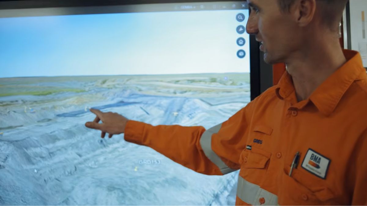
Quarry faces have to be surveyed, and the people surveying them should not be standing beneath them. Aerial capture produces the plans, cross-sections and models a geotechnical assessment requires, measures what has been extracted and stockpiled, and does it without a surveyor walking a bench or an operative approaching a face.
GEOTECHNICAL ASSESSMENT
Producing what the Quarries Regulations require
Regulation 30 of the Quarries Regulations 1999 places a general duty on the operator to ensure excavations and tips are designed, constructed, operated and maintained so that instability likely to give rise to risk is avoided. Regulation 32 requires appraisal by a competent person, and where a significant hazard is identified, Regulation 33 requires a detailed assessment by a geotechnical specialist.
Schedule 1 sets out what that assessment must contain, and the first requirement is a site survey: an accurate plan at a scale no less detailed than 1:2500, showing the quarry boundary, the excavation or tip, and any contiguous land or structures that might be affected. It then calls for site investigation, cross-sections and plans based on that investigation.
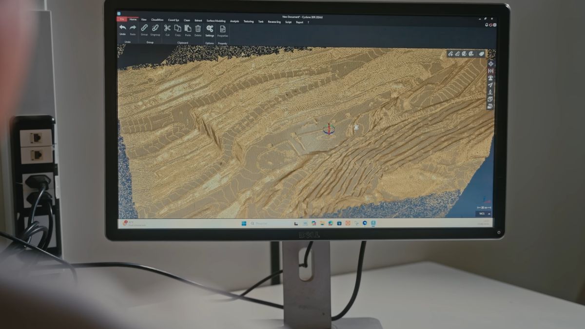
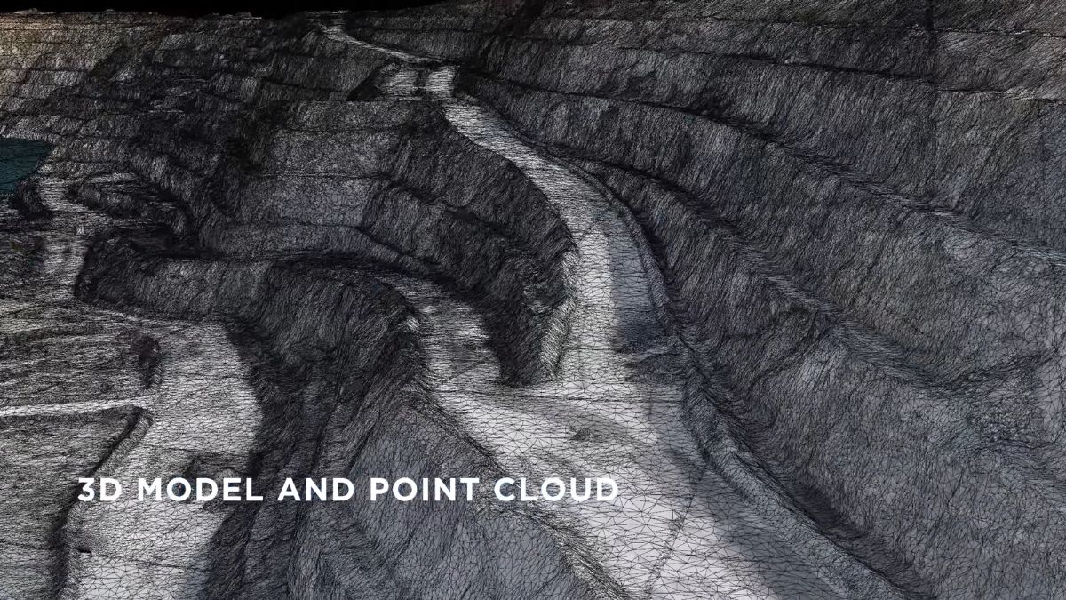
An aerial survey produces those deliverables directly. One flight yields an orthomosaic at well beyond the required scale, a terrain model the cross-sections are cut from, and a point cloud the geotechnical specialist can interrogate rather than working from a walked survey and a set of photographs.
- Produce plans and cross-sections at the detail Schedule 1 requires
- Capture contiguous land and structures within the same survey rather than as a separate exercise
- Model face geometry, bench widths and slope angles for stability analysis
- Compare repeat surveys to detect movement between assessments
- Record a dated, positioned dataset that supports the geotechnical file
FACES AND HIGHWALLS
Inspecting without standing underneath
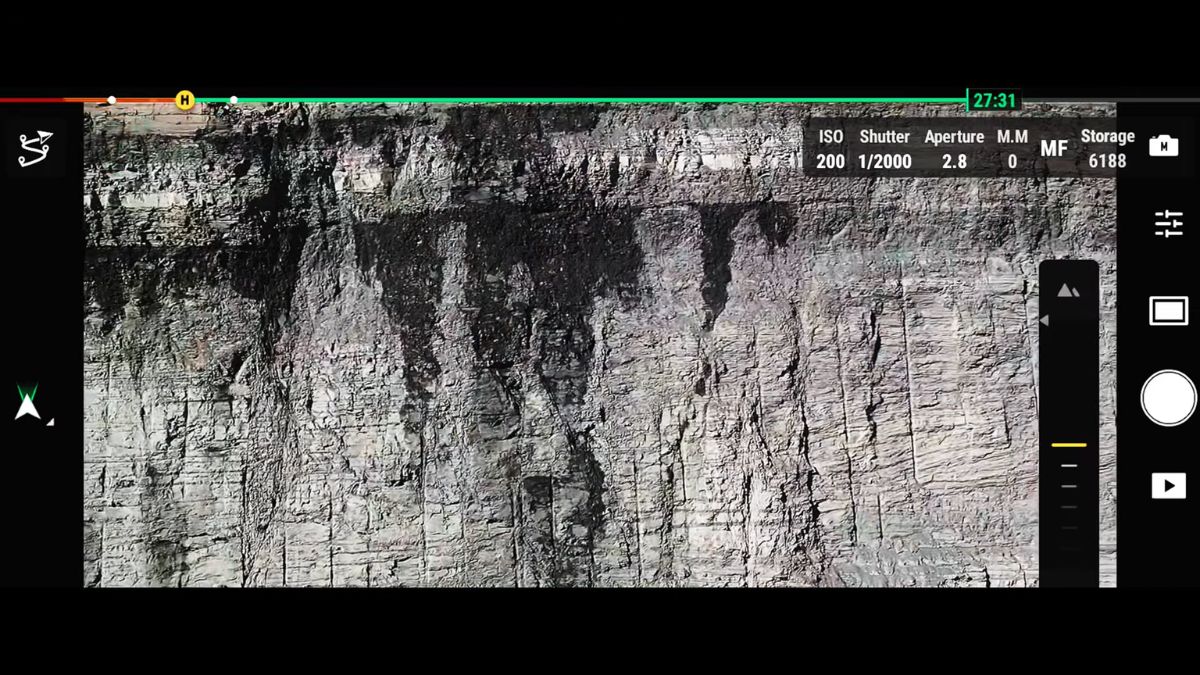
The hazard in face inspection is the face. HSE case material on quarry incidents includes collapses onto loading excavators, onto plant left beneath a face overnight, and onto equipment working below. Every one of those is an argument for putting a sensor in the air instead of a person at the toe.
The Matrice 4T at £5,910 runs visible, thermal and telephoto sensors simultaneously with 112x hybrid zoom and a laser rangefinder to 1,800 m, so a crack, an overhang or a loose block can be examined in detail from a stand-off distance.
- Inspect faces, benches and crests without approaching the toe
- Identify overhangs, loose material and developing tension cracks
- Survey faces after a blast before anyone works beneath them
- Monitor known features between formal assessments
- Document face condition with dated, positioned imagery
STOCKPILES AND VOLUMES
Measuring what has moved and what is on the ground
Stock figures sit on the balance sheet, and an independently measured volume carries more weight than an estimate. Aerial capture measures every stockpile on site in one flight, and the same dataset also gives you extraction volumes against the previous survey.
DJI Terra computes cut, fill and stockpile volumes against a known datum or an imported surface. Because capture is RTK-positioned, this month's surface compares directly against last month's without re-establishing anything.
Where a volume figure will be reported or reconciled against sales records, accuracy needs evidencing. The D-RTK 3 Multifunctional Station at £1,369 supplies corrections from a base on site without depending on mobile coverage, and Goecke ground control points from £10 each give you checkable reference marks. An Emlid Reach RS3 at £2,699 or RS4 at £3,599 covers ground control and checkpoint observation on foot.
- Measure every stockpile on site in a single flight
- Calculate extraction volumes against the previous survey
- Reconcile measured stock against sales and production records
- Report volumes with an auditable, dated dataset behind them
- Evidence accuracy with independently observed checkpoints
BLAST PLANNING
Face profiling and post-blast assessment
Drill and blast design depends on knowing the real geometry of the face, not the intended one. Burden varies along a face that has been worked, and a hole drilled to an assumed burden is where flyrock risk comes from.
An aerial survey gives an accurate face profile before the shot is designed, so burden can be calculated against measured geometry along the whole face rather than sampled at intervals. After the blast, the same capture method measures the muckpile, records fragmentation and confirms the new face position before anyone works beneath it.
- Profile faces accurately before drill and blast design
- Calculate burden against measured geometry rather than assumed values
- Measure muckpile volume and position after the shot
- Assess the new face from the air before anyone approaches it
- Record before and after conditions for the blast record
TIPS, LAGOONS AND RESTORATION
Monitoring what does not move until it does
Tips fall under the same regulatory regime as excavations, and Regulation 36 requires records of the nature, quantity and location of material at a notifiable tip sufficient to allow an accurate stability assessment. Aerial survey produces exactly that: a measured, dated record of what has been deposited and where.
Failures of excavated slopes and tips are reportable under RIDDOR, and the test is whether someone would have been hurt had they been there. A failure at a weekend on an empty site is still reportable, which is a strong argument for monitoring that does not depend on someone being present to notice.
- Record tip extent, volume and position for the stability assessment
- Monitor movement between surveys against a fixed baseline
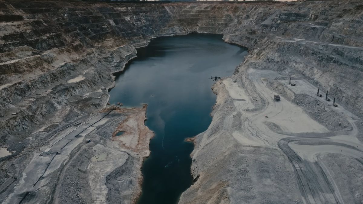
- Survey lagoons and settlement ponds without approaching the edge
- Track restoration progress against the planning condition
- Evidence compliance with consented boundaries and phasing
LIMITATIONS
What to be realistic about
Underground is out of scope. DJI make no confined space or GPS-denied platform, so shafts, adits, stopes and underground workings are outside what we can supply. That market sits with specialist manufacturers and we would point you toward them rather than sell you something unsuitable.
Photogrammetry handles overhangs poorly. It reconstructs what the camera sees, and an undercut face is the geometry it captures worst. Where overhangs matter, LiDAR from multiple angles is the correct tool.
It supports the geotechnical specialist, it does not replace one. The Regulations are specific about who makes the assessment. Aerial survey gives them better data.
Dust and weather affect capture. A working quarry generates dust, and photogrammetry needs clear line of sight. Plan surveys around processing activity as well as around weather.
Volume accuracy needs control to be evidenced. RTK alone reaches survey-grade accuracy on most work, but if a figure will be reconciled against sales or disputed, lay checkpoints
CHOOSING YOUR EQUIPMENT
Matching the platform to the site
DJI Matrice 4E - £3,940 20 MP factory-calibrated mapping camera, five-directional oblique capture, 49 minutes of endurance. The core platform for site survey, stockpile volumes and face profiling.
DJI Matrice 400 with Zenmuse L2 or L3 The LiDAR route, and the right answer where overhangs, vegetation on restored ground or bare-earth modelling matter. 59 minutes of endurance with multi-return capture.
DJI Matrice 4T - £5,910 Visible, thermal and telephoto sensors with 112x hybrid zoom and a laser rangefinder to 1,800 m. For face inspection, plant and infrastructure checks alongside survey.
D-RTK 3 Multifunctional Station - £1,369 Base station corrections across five GNSS constellations, independent of mobile coverage. Essential on sites in a hole with poor signal.
Emlid Reach RS3 - £2,699 A GNSS receiver that works as both a base and a survey rover, for establishing ground control and observing checkpoints on foot.
DJI Terra Processing into orthomosaics, terrain models, point clouds, cross-sections and volumetric calculations.
Drone Solutions for Mining and Quarrying Operations
Enhance your mining and quarrying operations with drone technology
CAPABILITIES
What quarry survey hardware has to do
A quarry survey has to produce measurable, positioned output that stands up in a geotechnical file and a stock report. The specifications below are what make that possible from the air.
20 MP mapping camera
A factory-calibrated 4/3 CMOS sensor with mechanical shutter, producing distortion-free imagery for orthomosaics and measurable models.
Five-directional oblique
Plan and face capture in a single automated pass, so a vertical highwall is imaged properly rather than foreshortened from directly above.
Multi-return LiDAR
Up to 16 returns per pulse, recovering ground beneath vegetation on restored ground, benches and overburden.
Centimetre positioning
RTK ties every capture to a centimetre-accurate position, so this quarter's survey registers against last quarter's and against the consented boundary.
Volumetric calculation
Cut, fill and stockpile volumes computed in DJI Terra against a known datum or a design surface.
Cross-sections and plans
Output at the scale and detail a geotechnical assessment requires, drawn from the survey rather than reconstructed from it.
Long-range zoom
112x hybrid zoom for close inspection of a face, a crack or a bench edge from a safe stand-off distance.
Endurance
Up to 59 minutes airborne, enough to complete a working face or a full site without a battery change mid-survey.
Repeatable routes
Identical flight lines flown to a saved plan, producing directly comparable datasets for movement monitoring.
WHO WE WORK WITH
Supplying UK extraction since 2015
Quarry operators, aggregates producers, mineral surveyors, geotechnical consultancies and restoration contractors buy their survey equipment from us. We are a DJI Enterprise A-Rank retailer, DJI's highest authorised retail tier, ISO 9001 certified, and YPO-approved for public sector procurement. We supply the aircraft, train the crew that flies it, and repair it in house when something goes wrong.
WHY DRONE SAFE STORE
Support beyond the purchase
Choosing the right aircraft is only the beginning. We support your operation from equipment selection and configuration through to training, rental, servicing and repair, all from our base in Chichester. We are a DJI Enterprise A-Rank retailer, ISO 9001 certified and a YPO-approved supplier for Drones and Associated Services. This gives operators, consultancies and public sector clients access to specialist DJI equipment and established procurement routes. You are also welcome to handle the aircraft at our DJI Experience Centre in Chichester, Monday to Saturday, before committing.
Accreditation
 Armed Forces Covenant
Proudly supporting the Armed Forces community and veterans.
Armed Forces Covenant
Proudly supporting the Armed Forces community and veterans.
 ISO 9001 Certified
Certified quality management systems for consistent service and customer satisfaction.
ISO 9001 Certified
Certified quality management systems for consistent service and customer satisfaction.
 DJI Enterprise A Rank Retailer
DJI's highest level of authorised retail and technical expertise.
DJI Enterprise A Rank Retailer
DJI's highest level of authorised retail and technical expertise.
 D-U-N-S® Registered
Globally recognised business identity, verified for international trade. Number: 221162020
D-U-N-S® Registered
Globally recognised business identity, verified for international trade. Number: 221162020
 Financial Conduct Authority
Authorised and regulated by the FCA for consumer finance activities.
Financial Conduct Authority
Authorised and regulated by the FCA for consumer finance activities.
 YPO Approved Supplier
Approved on the YPO framework as a supplier for Drones & Associated Services to help the Public Sector
YPO Approved Supplier
Approved on the YPO framework as a supplier for Drones & Associated Services to help the Public Sector
Get In Touch
Speak to Our Team
Speak to Our Mining and Quarrying Specialists.