
Drones for Maritime Operations
Vessel-based flight, offshore inspection, port operations and coastal survey
Working at sea removes the things drone operations normally depend on: a stable launch point, a fixed reference for positioning, and somewhere safe to put the aircraft down. Salt, wind and vessel movement then compound it. The hardware that handles this is a narrow subset of what is on the market. Drone Safe Store supplies UK maritime operators, offshore inspection contractors, port authorities, coastal survey teams and marine consultancies with DJI enterprise aircraft rated for vessel-based operation, alongside the thermal, LiDAR and positioning equipment those missions require. As a DJI Enterprise A-Rank retailer, ISO 9001 certified and YPO-approved for public sector procurement, we hold enterprise hardware in UK stock in Chichester and configure it before dispatch. Call 01243 859444 to talk through your operating environment.
VESSEL OPERATIONS
Launching and recovering from a moving deck
Recovering an aircraft to a vessel has traditionally meant a manual grab or precision flying against a deck that will not hold still. Both add risk and both limit the sea states you can work in.
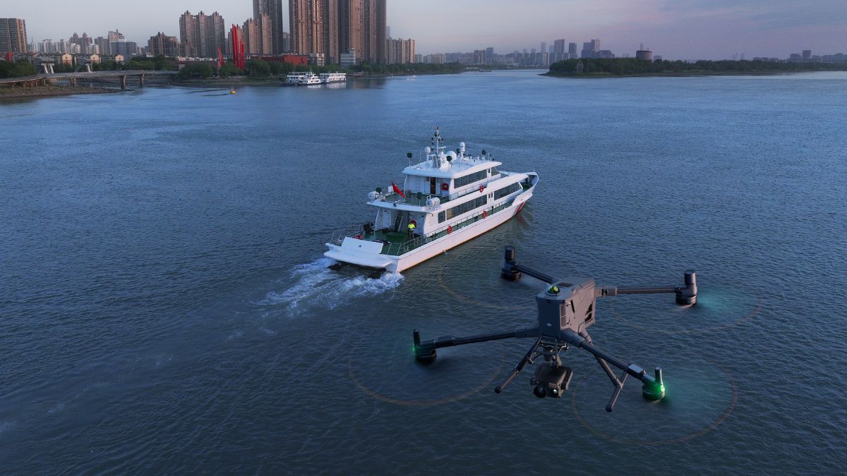
The DJI Matrice 400 automates it. Boat Launch mode supports takeoff from a stationary vessel and landing on a vessel moving at up to 10 knots, with the aircraft identifying a landing pattern on the deck to place itself accurately. DJI specify a clear 3 m by 3 m area with unobstructed overhead space, and recommend using the rear of the vessel.
Two operational points worth knowing before you plan around it. Boat Launch automatically disables downward obstacle avoidance, so the setting needs checking when the aircraft next flies over land. Maximum wind resistance during takeoff and landing is 12 m/s, which is a harder limit offshore than it sounds ashore.
- Launch and recover without a manual grab or a crew member in the recovery path
- Extend operating windows into moderate sea states rather than standing down
- Fly for up to 59 minutes carrying an H30T, reducing recovery cycles per task
- Operate an IP55-rated airframe rated from -20°C to 50°C
- Monitor surrounding traffic with a standard ADS-B In receiver detecting to 20 km
OFFSHORE WIND
Turbine and structure inspection
Blade, tower and transition piece inspection currently means rope access, a jack-up, or a helicopter, all of which are expensive and weather-limited. A drone flown from the crew transfer vessel already on station removes most of that cost and much of the risk.
The Zenmuse H30T combines a 40 MP zoom camera with 34x optical zoom and a 1280 x 1024 radiometric thermal sensor, so blade surface condition can be assessed in detail from a stand-off distance while thermal identifies subsurface defects and delamination that visual inspection alone will miss. An integrated laser rangefinder measuring to 3,000 m supports clearance and stand-off management around a rotating structure.
- Inspect blade leading edges, tower welds and transition pieces without rope access
- Detect subsurface delamination and moisture ingress thermally
- Document damage with geotagged imagery for repair scheduling and warranty claims
- Reduce technician time spent at height and over water
PORTS AND HARBOURS
Terminal, infrastructure and perimeter operations
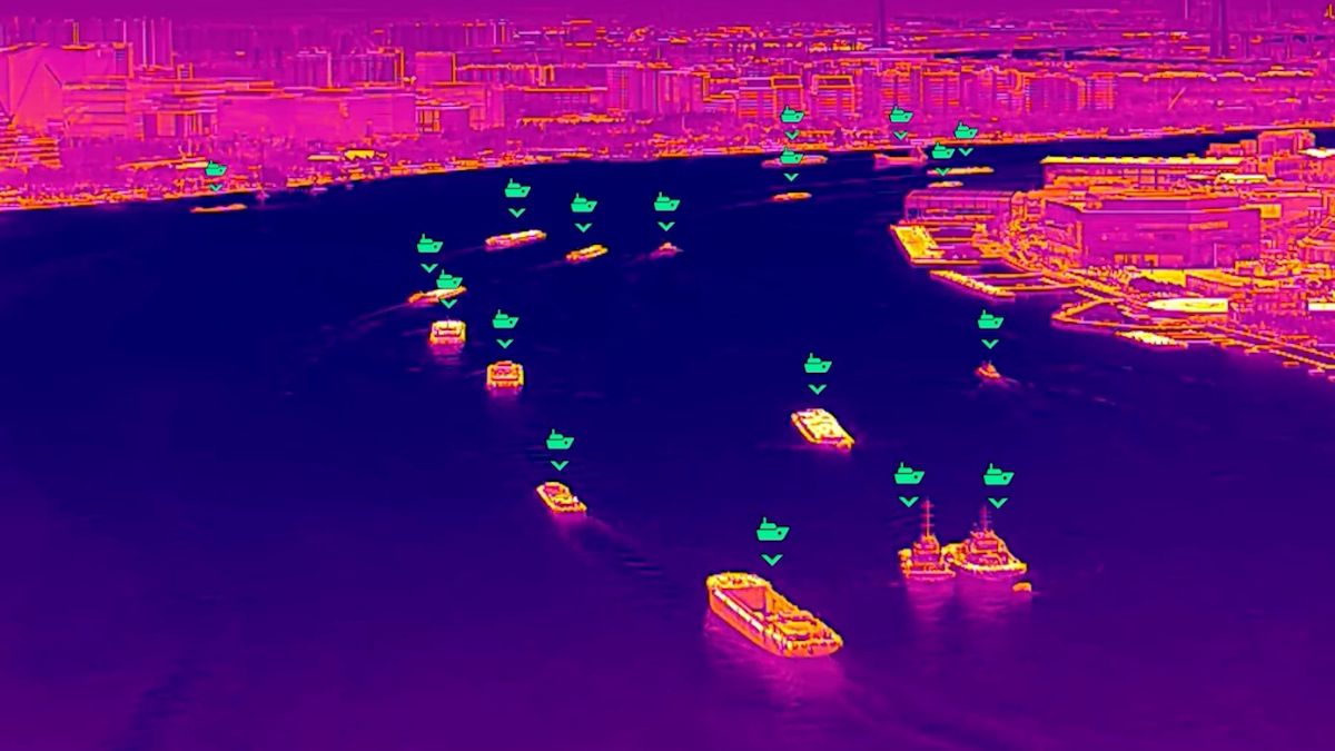
Ports combine large footprints, continuous operation and infrastructure that is awkward to inspect: quay walls, cranes, jetties, fendering and the underside of structures over water. Most of it cannot be reached without disrupting operations.
The Matrice 4T at £5,910 runs visible, thermal and telephoto sensors simultaneously with 49 minutes of endurance and 112x hybrid zoom, which covers structural inspection, incident response and general port survey on one aircraft. For frequent scheduled coverage, DJI Dock 3 with a Matrice 4TD at £16,795 runs missions through DJI FlightHub 2 without a pilot travelling to site.
- Inspect quay walls, cranes, jetties and fendering without closing a berth
- Survey stockpiles and yard inventory for volumetric reporting
- Patrol perimeters and water frontage on a schedule
- Respond to incidents with thermal and zoom imagery before crews arrive
COASTAL SURVEY
Shoreline mapping and erosion monitoring
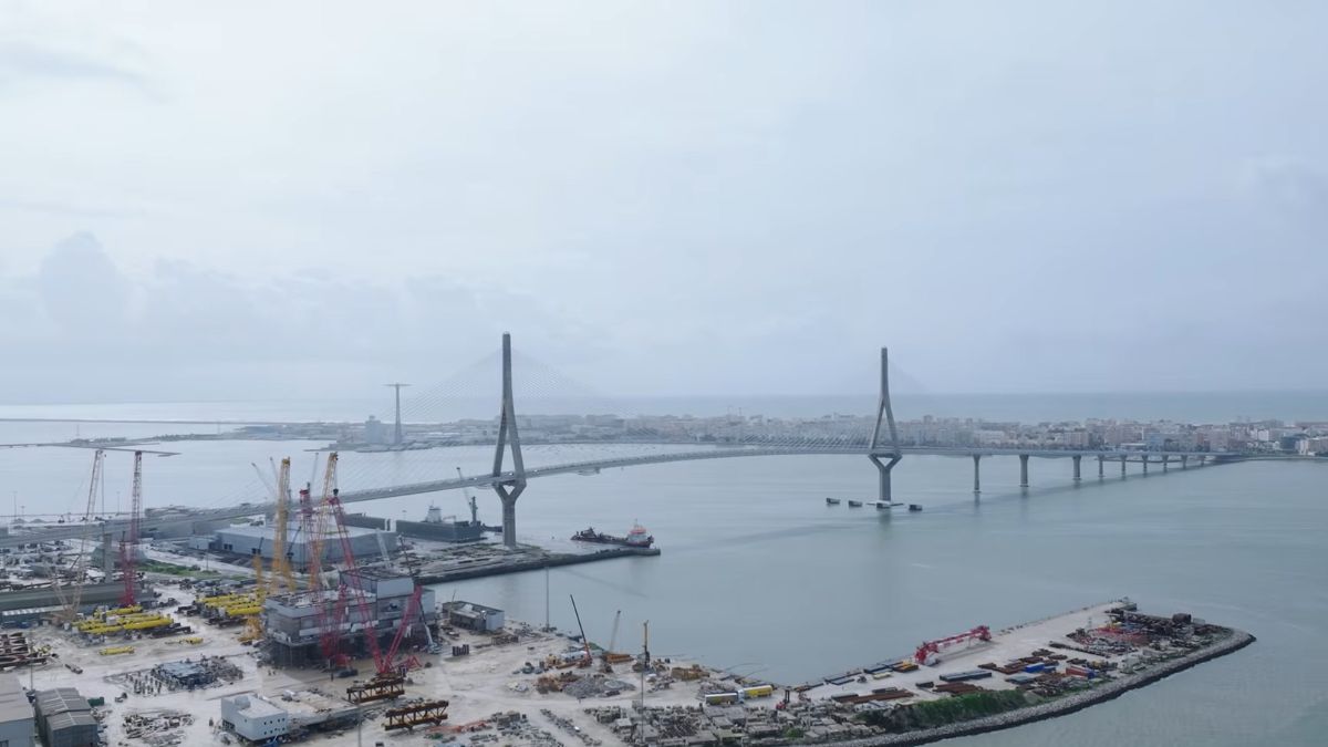
Coastal change is a monitoring problem rather than a one-off survey. It needs repeatable capture at a consistent standard so this year's shoreline can be measured against last year's, and that is what aerial survey does well.
The Matrice 4E captures 20 MP through a factory-calibrated 4/3 CMOS mapping camera at 49 minutes of endurance, producing orthomosaics and terrain models of beach, cliff and defence structures. Where vegetation obscures the ground behind a defence line, the Zenmuse L2 returns 4 cm vertical accuracy at 150 m and pushes returns through canopy that photogrammetry cannot see past.
The D-RTK 3 Multifunctional Station supplies corrections from a base station on site and does not depend on mobile coverage, which matters on exposed coastline where network RTK performs worst. DJI Terra processes the output into orthomosaics, terrain models and volumetric calculations for sediment budgeting.
Limitations
What aerial survey will not do at sea
Being straight about the limits matters more here than in most sectors, because marine environments defeat equipment in ways that are not obvious from a spec sheet.
Drone LiDAR does not do bathymetry. The Zenmuse L2 and L3 use near-infrared wavelengths, which water absorbs. They map the water surface, not the seabed. Bathymetric survey requires green-wavelength LiDAR or sonar, neither of which is available in the DJI range.
IP55 is not a corrosion rating. It covers dust ingress and low-pressure water jets, not prolonged salt exposure. Aircraft worked regularly offshore need rinsing and inspection as routine maintenance, and salt damage is generally excluded from manufacturer warranty. Budget for shorter service life than the same airframe would give ashore.
Steel decks interfere with compass calibration. Expect to calibrate away from the vessel structure and to see heading warnings on deck. This is manageable but it needs building into procedure rather than discovering on the day.
Offshore work frequently exceeds visual line of sight. BVLOS operation requires specific CAA authorisation, and the assessment for maritime operations is not a formality.
CAPABILITIES
Built for conditions that ground standard equipment
Vessel launch and recovery
Takeoff from a stationary vessel and landing on one moving at up to 10 knots, with the aircraft locating a deck pattern to place itself. Requires a clear 3 m by 3 m area.
59-minute endurance
Up to 59 minutes carrying a Zenmuse H30T, reducing recovery cycles per task and extending how far offshore a single sortie reaches.
IP55 weather rating
Rated from -20°C to 50°C with 12 m/s maximum wind resistance on takeoff and landing, keeping aircraft operational in conditions that stand lighter platforms down.
Stand-off inspection
34x optical zoom and 1280 x 1024 radiometric thermal, so blades, welds and fittings can be assessed in detail without approaching the structure.
Centimetre positioning
RTK fix accuracy of 1 cm + 1 ppm horizontally, with base station corrections that do not depend on mobile coverage.
Airspace awareness
Standard ADS-B In receiver detecting traffic to 20 km, relevant wherever operations share airspace with SAR and offshore rotary.
Obstacle sensing
Rotating LiDAR, six-direction mmWave radar and low-light fisheye vision, maintaining awareness around cranes, masts, rigging and turbine structures.
Multi-payload capability
Up to 6 kg across four E-Port V2 connectors, carrying thermal, LiDAR, photogrammetry, spotlight and speaker payloads on one airframe.
Scheduled autonomous operation
DJI Dock 3 with a Matrice 4TD flies routes to a schedule through FlightHub 2, covering fixed port and coastal assets without a pilot on site.
WHY DRONE SAFE STORE
Support beyond the purchase
Choosing the right aircraft is only the beginning, and marine conditions are harder on equipment than anything ashore. We support your operation from equipment selection and configuration through to training, rental, servicing and repair, all from our base in Chichester. We are a DJI Enterprise A-Rank retailer, ISO 9001 certified and a YPO-approved supplier for Drones and Associated Services. This gives offshore contractors, port and harbour authorities, marine consultancies and public sector organisations access to specialist DJI equipment and established procurement routes. Enterprise equipment can be configured, updated and tested before dispatch, while our training team provides A2 CofC, GVC and one-to-one instruction. We also offer equipment rental, in-house DJI servicing and repair, and access to our DJI Experience Centre in Chichester.
WHO WE WORK WITH
Supplying UK maritime operations since 2015
Offshore inspection contractors, port and harbour authorities, coastal engineering consultancies and marine survey teams buy their enterprise equipment from us. We are a DJI Enterprise A-Rank retailer, DJI's highest authorised retail tier, ISO 9001 certified, and YPO-approved for public sector procurement. We supply the aircraft, train the crew that flies it, and repair it in house when something goes wrong.
Accreditation
 Armed Forces Covenant
Proudly supporting the Armed Forces community and veterans.
Armed Forces Covenant
Proudly supporting the Armed Forces community and veterans.
 ISO 9001 Certified
Certified quality management systems for consistent service and customer satisfaction.
ISO 9001 Certified
Certified quality management systems for consistent service and customer satisfaction.
 DJI Enterprise A Rank Retailer
DJI's highest level of authorised retail and technical expertise.
DJI Enterprise A Rank Retailer
DJI's highest level of authorised retail and technical expertise.
 D-U-N-S® Registered
Globally recognised business identity, verified for international trade. Number: 221162020
D-U-N-S® Registered
Globally recognised business identity, verified for international trade. Number: 221162020
 Financial Conduct Authority
Authorised and regulated by the FCA for consumer finance activities.
Financial Conduct Authority
Authorised and regulated by the FCA for consumer finance activities.
 YPO Approved Supplier
Approved on the YPO framework as a supplier for Drones & Associated Services to help the Public Sector
YPO Approved Supplier
Approved on the YPO framework as a supplier for Drones & Associated Services to help the Public Sector
Get In Touch
Speak to a maritime specialist
Equipment choice for marine work depends on where you launch from, what you are inspecting, and the conditions you need to operate in. Tell us about the operation and we will tell you what it actually requires. Call 01243 859444 or send the form below.