
Survey-grade data capture, from air to deliverable
From photogrammetry and LiDAR to RTK, PPK and ground control, we supply complete DJI Enterprise systems for professional surveying and mapping workflows.
Drone Safe Store supplies UK survey teams and civil engineering contractors with drones for surveying and mapping, from integrated photogrammetry aircraft to long-range LiDAR payloads and GNSS ground control.
THE ADVANTAGE OF AERIAL CAPTURE
More coverage. Better data. Fewer site days.
Survey-grade positioning: RTK, PPK and ground control can be combined to establish and verify the positioning required for professional survey workflows.
Safer data capture: Capture quarries, infrastructure, unstable structures and difficult terrain without unnecessarily putting survey personnel into hazardous environments.
Greater site efficiency: Cover large areas efficiently and return to the office with the data required for mapping, modelling, measurement and volume calculations.
Photogrammetry
Detailed 2D and 3D reconstruction from RGB imagery
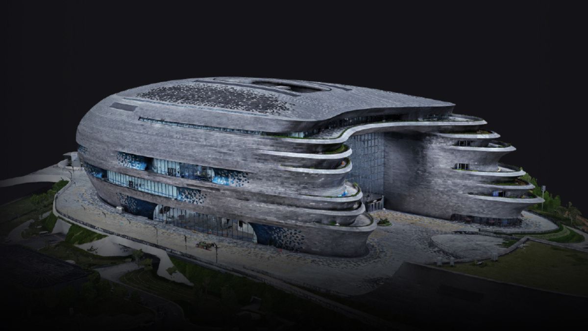
Photogrammetry builds georeferenced 2D orthomosaics and textured 3D models by triangulating overlapping images. The output is measurable, so a site engineer can pull distances, areas, and volumes straight from the model without returning to site. It suits progress monitoring, earthwork calculation, cadastral mapping, heritage recording, and facade documentation.
The Zenmuse P1: For large-area and demanding photogrammetry. Pairs a 45 MP full-frame sensor with interchangeable 24 mm, 35 mm, and 50 mm DL lenses on a three-axis gimbal. Its global mechanical shutter fires at 1/2000 s and TimeSync 2.0 aligns camera, flight controller, RTK module, and gimbal at microsecond level, which is what delivers 3 cm horizontal accuracy without laying ground control. A 0.7 second capture interval covers 3 km² in a single flight, rising to 7.5 km² across a working day with Smart Oblique Capture.
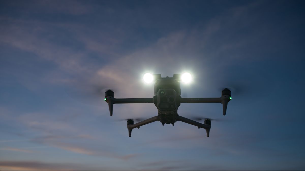
The Matrice 4E: For compact, integrated site surveying. Brings the same discipline to a compact airframe. Its 4/3 CMOS wide camera captures 20 MP through a mechanical shutter at a 0.5 second minimum interval, and every unit is factory-calibrated with residual distortion held under two pixels. Flight time reaches 49 minutes, enough to complete most site-scale area routes on a single battery.
Capture five-directional oblique imagery in a single automated pass, removing the second mobilisation a separate oblique flight would need
Generate a rough model on the controller with Smart 3D Capture, then fly a surface-following route against it for irregular structures
Process directly in DJI Terra, which reads the factory calibration parameters rather than solving them from scratch
Deploy the M4E for site-scale work and the P1 on a Matrice 400 or Matrice 350 RTK for corridor and large-area capture
LiDAR
Capture the ground beneath the canopy
LiDAR measures distance by timing laser pulses, so it does not depend on ambient light or surface texture. Where photogrammetry sees a tree canopy, LiDAR pushes pulses through the gaps and returns ground points beneath it. That makes it the correct tool for forestry, terrain modelling under vegetation, powerline corridors, and any site where a bare-earth DTM is the deliverable.
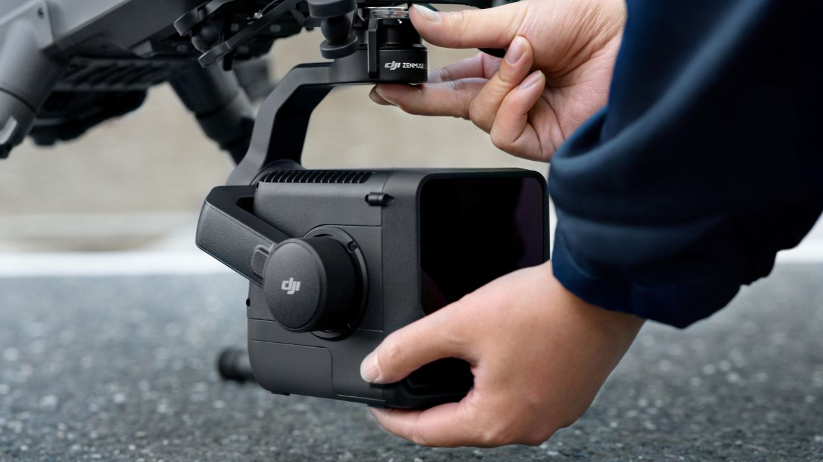
The Zenmuse L2 returns 4 cm vertical and 5 cm horizontal system accuracy at 150 m altitude, with a detection range of 250 m against 10% reflectivity targets in 100 klx conditions and 450 m against 50% reflectivity in darkness. It supports up to five returns per pulse and captures 1,200,000 points per second in multiple-return mode, covering 2.5 km² per flight. An integrated 4/3 CMOS RGB camera colourises the point cloud in the same pass.
The Zenmuse L3 extends that envelope considerably. Its 1535 nm laser reaches 950 m against 10% reflectivity targets at a 100 kHz pulse rate, and beam divergence of 0.25 mrad produces a spot roughly one fifth the size of the L2's, which is what allows it to resolve individual conductors and branches. Accuracy runs to 3 cm vertical and 4 cm horizontal RMSE at 120 m, holding 5 cm vertical at 300 m.
Adjust pulse rate from 100 kHz to 2 MHz to trade point density against altitude and coverage
Select Linear, Star-Shaped, or Non-Repetitive scanning to match terrain mapping, canopy penetration, or complex urban geometry
Record up to 16 returns per pulse for dense vegetation where a single return would miss ground entirely
Colourise point clouds from dual 100 MP mapping cameras with a combined 107° horizontal field of view
Cover up to 10 km² in a single flight at 300 m on a Matrice 400, supporting daily coverage approaching 100 km²
Case Study
Case Study: 32 Hectares in One Hour
The Site
Latitude Geospatial was commissioned to survey a 32-hectare industrial complex in central Norwich on behalf of a public housing and regeneration organisation.
The site comprised a complex mix of warehouses, food processing facilities, offices, green space and an abbey. The resulting dataset would support downstream planning and design, making complete site coverage essential.
The Constraints
The site sits alongside a live Greater Anglia rail line and close to Carrow Road. With Norwich City hosting an EFL Cup fixture during the planned operating window, the survey required careful coordination and flight planning.
Latitude Geospatial submitted flight plans through The Drone Map and DroneCloud, coordinated directly with Greater Anglia and Network Rail, and obtained a police incident number to ensure their contact details were held across the force ahead of the match.
The Solution
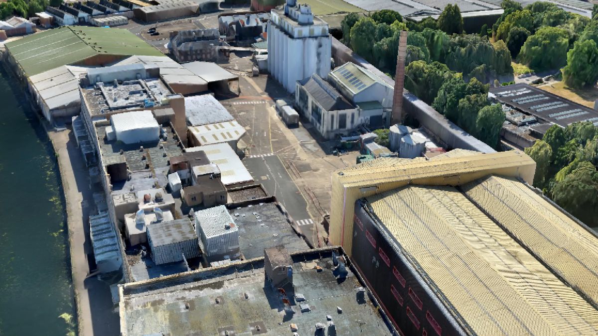
Latitude Geospatial deployed a DJI Zenmuse L3 mounted on a DJI Matrice 400, using the L3's star-shaped scanning mode to capture the site from multiple scan angles.
The system captured a colourised point cloud at 50% overlap, with deliverables including:
Dense mesh
Orthomosaic
Digital terrain model
Classified point cloud
Processing was completed using DJI Terra and Trimble Business Centre.
The Result
32 Hectares. One Hour.
Traditional ground-based surveying was estimated to require two surveyors working for two weeks or more.
Latitude Geospatial completed the aerial data capture in just one hour.
Why the L3 Suited This Project
A live industrial complex presents a very different surveying challenge from an open site. Access can be restricted, site operations continue around the survey team, and large areas of dense built geometry can take significant time to cover from the ground.
By moving the primary data capture into the air, Latitude Geospatial was able to survey the site without requiring surveyors to traverse the entire complex.
The L3's multi-angle scanning approach captured data across roofs, yards, vegetation and the abbey structure, providing a comprehensive dataset from a single aerial operation.
RTK, PPK and Ground Control
Anchoring your survey to real-world coordinates
RTK corrects aircraft position in flight by streaming corrections from a base station or network, tagging each image or laser pulse with a centimetre-accurate position as it is captured. PPK applies the same correction after landing, matching logged raw satellite observations from the aircraft against those from a base station. The practical difference is resilience: RTK needs an uninterrupted correction link throughout the flight, whereas PPK tolerates signal dropouts because the maths happens later.
Choose PPK for rural corridors, dense woodland, mountainous terrain, and anywhere mobile coverage is unreliable. Choose RTK when you need positional confidence in real time, or when the site has stable network coverage and you want the data usable straight off the card.
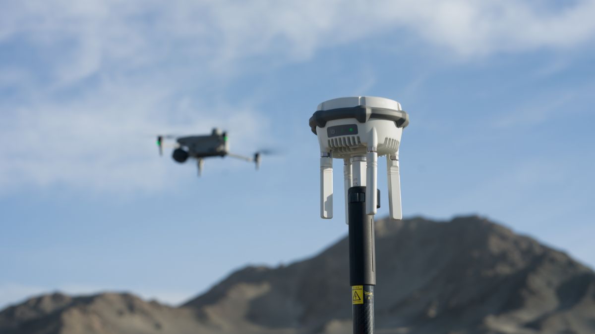
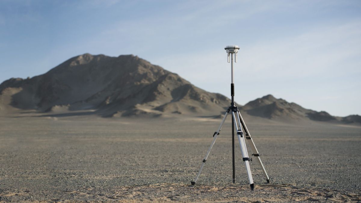
The D-RTK 3 Multifunctional Station covers both workflows. It tracks five GNSS constellations across 19 frequency points and operates in three modes: base station broadcasting corrections to multiple aircraft at once, relay station extending range through obstructed terrain, and rover station for establishing and checking ground control on foot. In rover mode it resolves to 0.8 cm + 1 ppm horizontal and 1.5 cm + 1 ppm vertical when fixed.
For PPK specifically, the D-RTK 3 logs raw satellite observations throughout the session. Import those alongside Matrice 4E capture data into DJI Terra 4.4 or later and local PPK resolves in a single click. Battery endurance runs to 10 hours in rover mode and 7 hours as a base station, which covers a full survey day without a swap.
Establish and check ground control points on foot in rover mode, then verify your aerial output against them
Broadcast corrections to several aircraft simultaneously from one base station on multi-crew sites
Extend operational range through built-up or wooded terrain using relay mode with the Matrice 4 Series
Record raw observations for PPK resolution when correction links cannot be guaranteed in the air
Pair with an Emlid Reach RS4 where you need iOS compatibility or a receiver that works outside the DJI ecosystem
Choosing Your Platform
Choosing between drones for surveying and mapping comes down to coverage area, payload requirement, and whether you need a bare-earth deliverable.
Matrice 4E
The fastest route into aerial survey
Integrated 4/3 CMOS mapping camera, factory-calibrated, nothing to specify or mount. Five-directional oblique capture in a single automated pass, so facades and roofs come back from the same flight as the plan view.
Captures 20 MP through a mechanical shutter at 0.5 second intervals
Holds residual distortion under two pixels, calibrated per unit at the factory
Flies 49 minutes, covering most site-scale area routes on one battery
Best for: construction progress, topographic survey up to site scale, teams buying their first survey aircraft.
Matrice 400
Large-area and corridor capture
The only platform that carries the Zenmuse L3, which reaches 950 m detection range and covers up to 10 km² in a single flight at 300 m altitude.
Flies 59 minutes, the longest endurance in the DJI enterprise range
Supports daily LiDAR coverage approaching 100 km² with the L3 mounted
Carries heavier multi-payload configurations for combined capture missions
Survey Software and Output
Process point clouds, orthomosaics and 3D models without leaving the DJI ecosystem
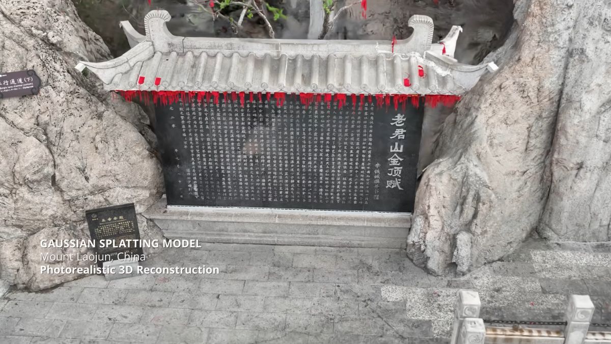
DJI Terra handles reconstruction end to end: 2D orthomosaics, 3D models, point cloud processing, PPK resolution, and volumetric calculation. It reads factory calibration parameters from DJI payloads directly, which improves reconstruction accuracy against a generic pipeline.
DJI Modify cleans and edits reconstructed 3D models, filling holes and removing artefacts before a model goes to a client.
DJI FlightHub 2 centralises flight planning, live mission monitoring, and data management across a fleet, with Business and Enterprise tiers available.
- Produce orthomosaic maps for measurement, area calculation, and progress records
- Generate digital surface and digital terrain models for earthwork and drainage design
- Deliver classified point clouds separating ground, vegetation, and structures
- Extract contour maps at your required interval for engineering design
- Build textured 3D models for stakeholder visualisation and BIM integration
- Calculate stockpile and excavation volumes against a known datum
SURVEY-GRADE PRECISION
Accuracy: Setting Realistic Expectations
Not every survey needs millimetre precision, and specifying for it wastes budget. Relative accuracy governs whether measurements within a dataset are correct against one another, which is sufficient for progress tracking, stockpile volumes, and change detection. Absolute accuracy governs whether the dataset sits correctly in a national grid, which matters for cadastral work, design deliverables, and anything tying into existing survey control.
RTK or PPK positioning combined with a small number of ground control points reliably achieves survey-grade absolute accuracy on standard commercial work. Checkpoints remain worth laying regardless of method, because they are how you evidence the accuracy you are claiming.
Our team will talk through your accuracy requirement before recommending hardware. Specifying an L3 for a job an M4E would complete is an expensive way to reach the same deliverable.
Build Your Surveying & Mapping Capability
Precision photogrammetry, LiDAR and RTK solutions for professional surveying and mapping. UK stock, professionally configured and prepared for deployment.
Capabilities
Why Drones Are Transforming Surveying & Mapping
Aerial surveying has become an increasingly powerful way to capture accurate geospatial data across construction, infrastructure, topography, quarrying and land management. Combining photogrammetry, LiDAR, RTK and advanced processing, modern drone systems can capture detailed survey data efficiently, safely and at scale.
Faster Data Capture
Cover large areas efficiently from the air, reducing time spent collecting data manually across extensive or difficult-to-access sites.
Survey-Grade Photogrammetry
Capture high-resolution imagery for orthomosaics, 3D models, topographic mapping, site documentation and volumetric measurement.
High-Density LiDAR
Capture detailed terrain and infrastructure data, including ground information beneath vegetation where photogrammetry may be less effective.
Precise Positioning
RTK and PPK workflows provide accurate aerial positioning, while ground control and independent checkpoints can be incorporated where verified absolute accuracy is required.
Safer Site Operations
Capture quarries, steep terrain, unstable structures, infrastructure and other challenging environments without unnecessarily exposing survey personnel to difficult or hazardous conditions.
Accurate Volumetric Measurement
Generate detailed 3D datasets for calculating stockpiles, earthworks, aggregates and material volumes with a repeatable aerial workflow.
Large-Area & Corridor Surveying
Efficiently capture extensive sites, linear infrastructure and difficult-to-access corridors using platforms and payloads selected around the scale of the project.
Repeatable Site Monitoring
Return to the same site and repeat aerial capture to monitor progress, identify changes and create consistent datasets over time.
From Capture to Deliverable
Turn aerial imagery and LiDAR into usable survey outputs including orthomosaics, point clouds, digital terrain models, contours, 3D models and volumetric calculations.
Drone Solutions for Surveying and Mapping
Enhance your Surveying and Mapping Capabilities with Drone Technology
Who We Work With
Your Survey Technology Partner
Public sector buyers procure through our YPO approval, so councils, highways authorities and other public bodies can order without running a fresh tender. We hold ISO 9001 certification, which covers the quality management evidence most tender documents ask for, and we are a DJI Enterprise A-Rank retailer, DJI's highest authorised retail tier. Geospatial and survey consultancies buying LiDAR and photogrammetry payloads for commercial contract work Civil engineering and construction contractors bringing progress capture and earthwork volumes in house Local authorities and highways teams procuring through YPO against existing framework arrangements Utilities and infrastructure operators running corridor and asset survey programmes Land and estate managers mapping holdings for planning, forestry and development We supply the aircraft, the payload, the ground control and the processing software, then train the crew that flies it and repair it in house when something goes wrong.
WHY DRONE SAFE STORE
Survey kit is only half of what you need
From choosing the right aircraft and payload to positioning, processing, training and ongoing support, we can provide everything you need to build a reliable survey workflow. Based in Chichester, we supply and support DJI Enterprise survey equipment, D-RTK 3, Emlid GNSS and DJI Terra, with systems configured and checked before dispatch. We also offer A2CofC, GVC and practical one-to-one training, equipment hire for live projects, and in-house DJI servicing and repairs. As a DJI Enterprise A-Rank retailer, ISO 9001 certified business and YPO-approved supplier, we support survey, construction, engineering and public-sector teams across the UK. Need help choosing the right setup? Talk to our team before you buy.
Accreditation
 Armed Forces Covenant
Proudly supporting the Armed Forces community and veterans.
Armed Forces Covenant
Proudly supporting the Armed Forces community and veterans.
 ISO 9001 Certified
Certified quality management systems for consistent service and customer satisfaction.
ISO 9001 Certified
Certified quality management systems for consistent service and customer satisfaction.
 DJI Enterprise A Rank Retailer
DJI's highest level of authorised retail and technical expertise.
DJI Enterprise A Rank Retailer
DJI's highest level of authorised retail and technical expertise.
 D-U-N-S® Registered
Globally recognised business identity, verified for international trade. Number: 221162020
D-U-N-S® Registered
Globally recognised business identity, verified for international trade. Number: 221162020
 Financial Conduct Authority
Authorised and regulated by the FCA for consumer finance activities.
Financial Conduct Authority
Authorised and regulated by the FCA for consumer finance activities.
 YPO Approved Supplier
Approved on the YPO framework as a supplier for Drones & Associated Services to help the Public Sector
YPO Approved Supplier
Approved on the YPO framework as a supplier for Drones & Associated Services to help the Public Sector
Get In Touch
Speak to Our Survey Specialists Today
Tell us about your surveying requirements and we can support you with this.