
Drones for Energy Inspection
Thermal, visual and LiDAR inspection across solar, overhead lines and substations
Energy assets can be difficult and costly to inspect. Components are spread across long distances, positioned at height or within live infrastructure, and some faults first appear as heat rather than visible damage. Drones provide a practical way to inspect these assets while keeping crews away from difficult areas and producing visual, thermal and LiDAR data that can be recorded and compared over time. Drone Safe Store supplies DJI Enterprise aircraft, thermal payloads, LiDAR and positioning equipment for solar, powerline and substation inspection. We are a DJI Enterprise A-Rank retailer, ISO 9001 certified and YPO-approved, with enterprise equipment held and configured at our Chichester facility. Call 01243 859444 to discuss your inspection requirements.
THE INSPECTION CASE
Three inspection problems drones solve
Distance. Transmission corridors, distribution networks and utility-scale arrays spread across terrain that takes days to inspect on foot or by vehicle. An aircraft covers the same ground in a fraction of the time, at a consistent standard.
Access. Conductors, insulators, tower fittings and array faces sit at height or at angles that cannot be inspected properly from ground level. Flying puts the sensor where the inspection needs it, without lifting equipment or a climbing team.
Early warning. Most electrical failures announce themselves as heat before anything else. A radiometric sensor records an actual temperature value per pixel, so a degrading joint can be tracked and prioritised rather than discovered after it fails.
- Reduce time spent working at height or adjacent to live conductors and switchgear
- Inspect more frequently, because cost per inspection falls far enough to make it viable
- Record findings as measurable, geolocated data that supports warranty and insurance claims
- Compare repeat inspections against a consistent baseline to identify degradation trends
- Prioritise maintenance by severity rather than by whatever was noticed first
SOLAR PV
Solar panel and solar farm inspection
Solar panel inspection
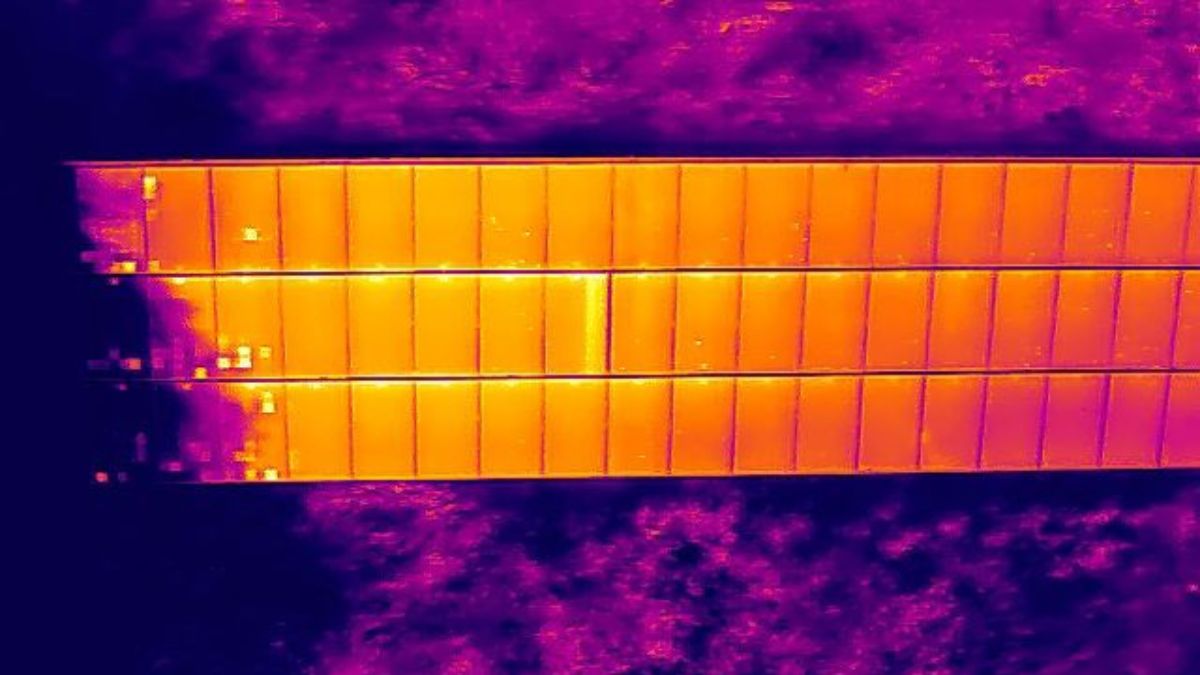
Thermal imaging allows inspection teams to identify abnormal heat patterns across solar panels and large PV arrays. Combined with visual imagery, it can highlight areas that require further investigation without checking every module from the ground.
Thermal inspections can identify:
Cell and module hot spots, which may indicate cracking, shading, soiling or other faults
Substring heating, which can indicate a bypass diode or connection issue
String-level abnormalities, highlighting potential faults in connections, fuses or combiner equipment
Junction box heating, which can indicate a connection or diode fault
Other irregular thermal patterns that warrant further investigation
A thermal image does not confirm the cause of a fault. Ground-level testing may still be needed to establish the root cause. Microcracks that have not produced a measurable temperature difference will also not appear in a thermal inspection.
Conditions matter
Reliable aerial thermography depends on the conditions during the flight. IEC TS 62446-3 provides guidance for outdoor PV thermography, including requirements for irradiance, wind, cloud cover, module operation and image resolution.
For larger solar sites, thermal sensor resolution affects the altitude and area that can be covered while maintaining sufficient detail. Higher-resolution sensors can maintain the required level of detail at greater distances, reducing the number of flight lines and sorties required.
DJI equipment for solar inspection
Matrice 4T
A compact option for commercial solar installations, combining thermal and visual cameras with a laser rangefinder.
Matrice 400 with Zenmuse H30T
A larger platform for more demanding inspection work, with a 1280 × 1024 thermal sensor and longer flight capability for larger sites.
For smaller rooftop and commercial installations, the Mavic 3 Thermal remains an option where its capabilities meet the requirements of the inspection.
POWERLINE AND TRANSMISSION
Overhead line and network inspection
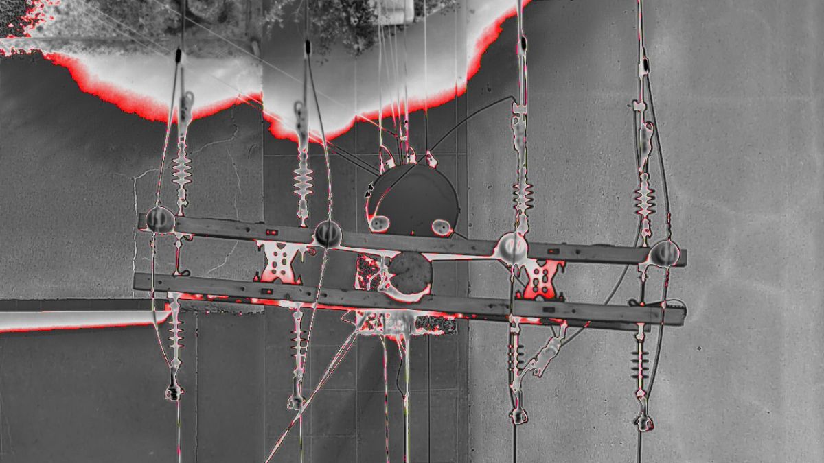
Drones provide a practical way to inspect overhead powerlines, towers and fittings without relying on ground access or helicopter surveys. High-resolution cameras, thermal imaging and LiDAR can be used to assess equipment condition, identify faults and monitor vegetation along the network.
The DJI Matrice 400 is well suited to powerline inspection, with advanced obstacle sensing and Power Line AR to help pilots identify conductors during flight. With up to 59 minutes of flight time when fitted with the H30T, it can cover longer sections of network between battery changes.
Thermal inspection
The Zenmuse H30T combines a 1280 × 1024 radiometric thermal camera with a 40 MP zoom camera and laser rangefinder.
Thermal imaging can help identify:
Overheating joints, clamps and splices
Insulator and connection issues
Abnormal heat patterns in electrical equipment
Components requiring closer inspection
The zoom camera and laser rangefinder also allow individual fittings and components to be inspected from a safe stand-off distance.
LiDAR and vegetation management
Vegetation encroachment can create clearance and reliability issues across overhead networks. LiDAR provides accurate three-dimensional data that can be used to measure the position of conductors and vegetation.
The Zenmuse L3 can capture detailed point clouds for:
Conductor and line modelling
Vegetation clearance measurement
Sag and clearance analysis
Vegetation growth monitoring
Corridor mapping
This gives inspection teams measurable data on the relationship between the line and surrounding vegetation, helping identify areas that require maintenance.
SUBSTATIONS
Substation and switchgear inspection
Drones provide a safer and more practical way to inspect substations and electrical equipment without putting personnel close to live assets or requiring access equipment.
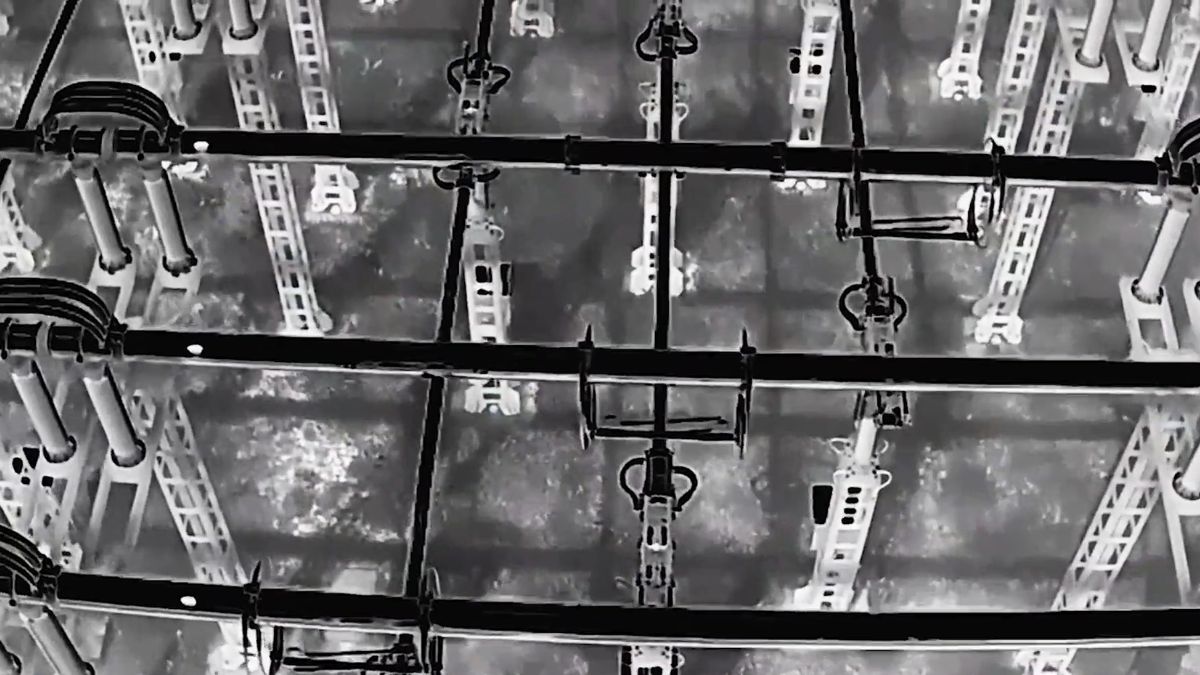
Thermal and visual cameras can inspect equipment such as bushings, busbar connections, transformer radiator banks and switchgear from the air. Radiometric thermal imaging also provides measurable temperature data that can be recorded and compared between inspections.
Thermal inspection can help:
Identify overheating bushings, connections and switchgear
Monitor transformer and radiator temperatures
Inspect equipment above ground level without scaffolding or MEWPs
Record thermal data for reporting and future comparison
DJI equipment for substation inspection
The Matrice 4T combines thermal, visual and telephoto cameras in a compact platform suited to many substation inspections.
For larger or more demanding sites, the Zenmuse H30T on a Matrice 400 provides higher-resolution thermal imaging, powerful optical zoom and a laser rangefinder for detailed inspection from a safe distance.
For sites that require regular or scheduled inspections, DJI Dock 3 with Matrice 4TD can automate planned flights through DJI FlightHub 2, reducing the need for an operator to travel to site for every inspection.
Thermal drones for energy inspection
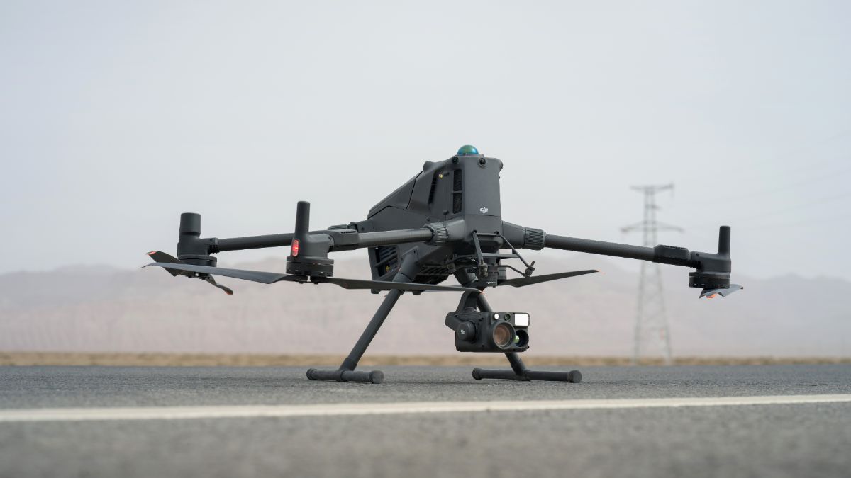
Our range of DJI Enterprise thermal drones is designed for energy inspection across solar farms, powerlines and substations. Choose from compact systems for rooftop and commercial solar inspections through to larger platforms with higher-resolution thermal sensors for utility-scale infrastructure.
Turning captures into an inspection record
DJI Terra processes imagery and LiDAR into orthomosaics, 3D models and classified point clouds, giving you a site model that findings can be plotted against. DJI FlightHub 2 centralises route planning, live monitoring and data management across a fleet, with Business and Enterprise tiers available.
CHOOSE YOUR PLATFORM
Which drone is right for energy inspection?
The right aircraft depends on the asset, the area to be covered and the type of data you need to collect.
Matrice 4T
A compact thermal platform for solar installations, substations and distribution network inspection.
Matrice 400 with Zenmuse H30T
A larger platform for longer inspections and detailed visual and thermal work across powerlines, substations and large solar sites.
Matrice 400 with Zenmuse L3
For LiDAR mapping, powerline corridors, vegetation management and detailed 3D modelling of energy infrastructure.
DJI Dock 3 with Matrice 4D Series
For repeatable, scheduled inspections where the aircraft can remain at the site and missions can be managed remotely.
Not sure which setup fits your operation? Talk to our Enterprise team.
TRY BEFORE YOU BUY
Rent the sensor first
Sensor resolution is the hardest decision to judge from a spec sheet and the one that matters most. Renting lets you inspect your own asset and see what the sensor resolves at the altitude your work requires.
Rental DJI Matrice 4TD Thermal Drone Combo, £379 per week, shipping and collection included
Rental H30T Thermal Camera, £399 per week
Rentals also cover one-off inspection contracts where purchase is hard to justify. All rentals require a valid Flyer ID, Operator ID and current insurance before dispatch.
Drone Solutions for Energy Inspection
Enhance Your Energy Inspection Capabilities with Drone Technology
CAPABILITIES
Why Drones Are Transforming Energy Inspection
Drone technology provides a practical way to inspect solar farms, powerlines, substations and other energy infrastructure. Combining high-resolution imaging, radiometric thermal cameras, LiDAR and precise positioning, modern drone systems can identify defects, measure assets and capture detailed inspection data without putting crews unnecessarily close to difficult or live infrastructure.
Thermal Fault Detection
Radiometric thermal cameras identify abnormal heat patterns across solar panels, electrical connections, switchgear and other equipment, helping inspection teams locate potential faults for further investigation.
High-Resolution Visual Inspection
Capture detailed imagery of conductors, insulators, clamps, substations, transformers and other components that can be difficult to inspect safely from the ground.
Solar Panel Inspection
Inspect large solar arrays for hot spots, string abnormalities, junction box issues and other visible or thermal defects, allowing maintenance teams to focus on areas requiring further investigation.
Powerline & Corridor Inspection
Capture detailed data along overhead powerlines, including conductors, towers, fittings and surrounding vegetation. LiDAR can be used to assess clearances and model the relationship between infrastructure and the surrounding corridor.
Substation Inspection
Inspect substations, switchgear, transformers, bushings and other electrical equipment from a safe stand-off distance, using thermal and zoom cameras to identify areas requiring closer attention.
LiDAR & 3D Mapping
Create detailed point clouds and 3D models of substations, powerline corridors and energy sites. LiDAR provides accurate spatial data for measuring clearances, modelling assets and monitoring vegetation.
Precise Positioning
RTK positioning records accurate aircraft locations during capture, helping inspection teams locate findings on large sites and return to the same assets during future inspections.
Repeatable Asset Monitoring
Repeat flight routes and consistent data capture make it possible to monitor changes in asset condition, vegetation growth and thermal patterns over time.
From Capture to Inspection Record
Turn aerial imagery, thermal data and LiDAR into usable inspection outputs, including thermal reports, annotated imagery, orthomosaics, point clouds, 3D models and asset-level records.
WHY DRONE SAFE STORE
Support beyond the purchase
Choosing the right aircraft is only the beginning. We support your operation from equipment selection and configuration through to training, rental, servicing and repair, all from our base in Chichester. We are a DJI Enterprise A-Rank retailer, ISO 9001 certified and a YPO-approved supplier for Drones and Associated Services. This gives commercial operators, utilities, local authorities and other public sector organisations access to specialist DJI equipment and established procurement routes. Enterprise equipment can be configured, updated and tested before dispatch, while our training team provides A2 CofC, GVC and one-to-one instruction. We also offer equipment rental, in-house DJI servicing and repair, and access to our DJI Experience Centre in Chichester.
WHO WE WORK WITH
Supplying UK energy inspection since 2015
O&M contractors, DNOs, EPCs, solar asset managers and utilities buy their thermal and LiDAR equipment from us. We are a DJI Enterprise A-Rank retailer, DJI's highest authorised retail tier, ISO 9001 certified, and YPO-approved for public sector procurement. We supply the aircraft, train the crew that flies it, and repair it in house when something goes wrong.
Accreditation
 Armed Forces Covenant
Proudly supporting the Armed Forces community and veterans.
Armed Forces Covenant
Proudly supporting the Armed Forces community and veterans.
 ISO 9001 Certified
Certified quality management systems for consistent service and customer satisfaction.
ISO 9001 Certified
Certified quality management systems for consistent service and customer satisfaction.
 DJI Enterprise A Rank Retailer
DJI's highest level of authorised retail and technical expertise.
DJI Enterprise A Rank Retailer
DJI's highest level of authorised retail and technical expertise.
 D-U-N-S® Registered
Globally recognised business identity, verified for international trade. Number: 221162020
D-U-N-S® Registered
Globally recognised business identity, verified for international trade. Number: 221162020
 Financial Conduct Authority
Authorised and regulated by the FCA for consumer finance activities.
Financial Conduct Authority
Authorised and regulated by the FCA for consumer finance activities.
 YPO Approved Supplier
Approved on the YPO framework as a supplier for Drones & Associated Services to help the Public Sector
YPO Approved Supplier
Approved on the YPO framework as a supplier for Drones & Associated Services to help the Public Sector
Get In Touch
Speak to Our Thermal Specialists Today
Tell us about your energy inspection requirements and we can help support you with this.